Mismīyah geodata
Mismīyah (Daraa) is a seat of a third-order administrative division; located in Syria in Asia/Damascus (GMT+3) time zone. In our database, there are 87 cities with bigger population. Compared to other cities in Syria, 89% of cities are located further ↑North; 61.8% of cities are located further →East and 68.9% of cities have lower elevation than Mismīyah. Note1


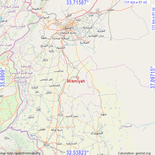
Mismīyah GPS coordinates[2]
33° 7' 44.472" North, 36° 23' 38.472" East
| Map corner | latitude | longitude |
|---|---|---|
| Upper-left | 33.71587°, | 35.6909° |
| Center: | 33.12902°, | 36.39402° |
| Lower-right: | 32.53823°, | 37.09715° |
| Map W x H: | 130.9×130.9 km | = 81.3×81.3mi |
| max Lat: | 37.17701° ⇑89% North |
| Mismīyah: | 33.12902° |
| min Lat: | ⇓11% South 32.39332° |
| min Long | Mismīyah | max Long |
| 35.75572° | 36.39402° | 42.14006° |
| W 38.2%⇐ | ⇒61.8% E |
Elevation
Elevation of Mismīyah is 618 m = 2028 ft, and this is 88.9 m = 292 ft above average elevation for this country.
| Max E: |
1640 m = 5381 ft | 31.1% |
| Mismīyah | 618 m 2028 ft | |
| Avg. | 529.1 m = 1736 ft | |
Min E: |
4 m = 13 ft | 68.9% |
See also: Syria elevation on elevation.city.
Geographical zone
Mismīyah is located in North temperate zone (between Tropic of Cancer and the Arctic Circle). Distance of this Northern Tropic circle is 1077.7 km =669.7 mi to South.| Distance of | km | miles | from Mismīyah |
|---|---|---|---|
| North Pole | 6323.5 | 3929.2 | to North |
| Arctic Circle | 3717.6 | 2310 | to North |
| Tropic Cancer | 1077.7 | 669.7 | to South |
| Equator | 3683.6 | 2288.9 | to South |


Nearby cities:
15 places around Mismīyah: (largest is in red/bold)
• Al Ghizlānīyah
30.3 km =18.8 mi,  10°
10°
• Al Kiswah
29.1 km =18.1 mi,  330°
330°
• Al Ḩajar al Aswad
37.5 km =23.3 mi,  347°
347°
• Aş Şanamayn
20.6 km =12.8 mi,  252°
252°
• Aş Şūrah aş Şaghīrah
19.9 km =12.4 mi,  122°
122°
• Dayr al ‘Aşāfīr
37.5 km =23.3 mi,  3°
3°
• Ghabāghib
16.8 km =10.4 mi,  290°
290°
• Inkhil
27.7 km =17.2 mi,  243°
243°
• Izra‘
31.5 km =19.6 mi,  204°
204°
• Jāsim
34.6 km =21.5 mi, 243°
• Sahnaiya
36.5 km =22.7 mi, 334°
• Shahbā
37.5 km =23.3 mi,  144°
144°
• Shaqqā
38.2 km =23.7 mi,  132°
132°
• Şalākhid
33 km =20.5 mi,  149°
149°
• ‘Arīqah
27.9 km =17.3 mi,  162°
162°
Sources, notices
• [Note1] Compared only with cities in Syria existing in our database
• [Src1] Map data: © OpenStreetMap contributors (CC-BY-SA)
• [Src2] Other city data from geonames.org with taken over terms of usage.
• [Src3] Geographical zone / Annual Mean Temperature by Robert A. Rohde @ Wikipedia
