Sokodé geodata
Sokodé (Centrale) is a seat of a first-order administrative division; located in Togo in Africa/Lome (GMT+0) time zone. With population of 117,811 people, there is 1 city with bigger population in this country. Compared to other cities in Togo, 55% of cities are located further ↓South; 55% of cities are located further →East and 85% of cities have lower elevation than Sokodé. Note1


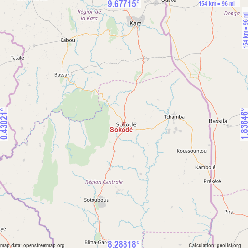
Sokodé GPS coordinates[2]
8° 58' 59.988" North, 1° 7' 59.988" East
| Map corner | latitude | longitude |
|---|---|---|
| Upper-left | 9.67715°, | 0.43021° |
| Center: | 8.98333°, | 1.13333° |
| Lower-right: | 8.28818°, | 1.83646° |
| Map W x H: | 154.4×154.4 km | = 95.9×95.9mi |
| max Lat: | 10.86225° ⇑45% North |
| Sokodé: | 8.98333° |
| min Lat: | ⇓55% South 6.12874° |
| min Long | Sokodé | max Long |
| 0.20762° | 1.13333° | 1.5919° |
| W 45%⇐ | ⇒55% E |
Elevation
Elevation of Sokodé is 402 m = 1319 ft, and this is 134.9 m = 443 ft above average elevation for this country.
| Max E: |
608 m = 1995 ft | 15% |
| Sokodé | 402 m 1319 ft | |
| Avg. | 267.1 m = 876 ft | |
Min E: |
5 m = 16 ft | 85% |
See also: Sokodé elevation on elevation.city.
Geographical zone
Sokodé is located in North Torrid zone (between Equator and Tropic of Cancer). Distance of Equator is 998.9 km =620.7 mi to South.| Distance of | km | miles | from Sokodé |
|---|---|---|---|
| North Pole | 9008.2 | 5597.4 | to North |
| Arctic Circle | 6402.3 | 3978.2 | to North |
| Tropic Cancer | 1607.1 | 998.6 | to North |
| Equator | 998.9 | 620.7 | to South |


Nearby cities:
15 places around Sokodé: (largest is in red/bold)
• Amlamé
170.6 km =106 mi,  188°
188°
• Atakpamé
161.2 km =100.2 mi,  180°
180°
• Badou
166.4 km =103.4 mi,  200°
200°
• Bafilo
43.3 km =26.9 mi,  19°
19°
• Bassar
48.7 km =30.3 mi,  307°
307°
• Dapaong
232.2 km =144.3 mi,  334°
334°
• Kandé
108.8 km =67.6 mi,  354°
354°
• Kara
63.4 km =39.4 mi,  5°
5°
• Kpalimé
238.1 km =147.9 mi, 193°
• Niamtougou
87.3 km =54.2 mi,  357°
357°
• Notsé
226.1 km =140.5 mi, 179°
• Pagouda
88.1 km =54.7 mi, 14°
• Sansanné-Mango
169.3 km =105.2 mi, 334°
• Sotouboua
49.5 km =30.8 mi, 199°
• Tchamba
31.6 km =19.6 mi,  79°
79°
Sources, notices
• [Note1] Compared only with cities in Togo existing in our database
• [Src1] Map data: © OpenStreetMap contributors (CC-BY-SA)
• [Src2] Other city data from geonames.org with taken over terms of usage.
• [Src3] Geographical zone / Annual Mean Temperature by Robert A. Rohde @ Wikipedia
