Pagouda geodata
Pagouda (Kara) is a populated place; located in Togo in Africa/Lome (GMT+0) time zone. With population of 7,686 people, there are 20 cities with bigger population in this country. Compared to other cities in Togo, 80% of cities are located further ↓South; 80% of cities are located further ←West and 90% of cities have lower elevation than Pagouda. Note1


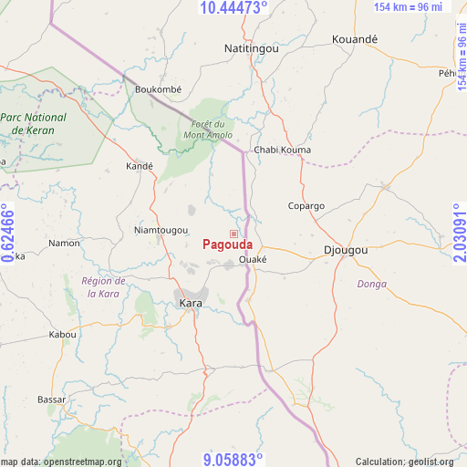
Pagouda GPS coordinates[2]
9° 45' 9" North, 1° 19' 40.008" East
| Map corner | latitude | longitude |
|---|---|---|
| Upper-left | 10.44473°, | 0.62466° |
| Center: | 9.7525°, | 1.32778° |
| Lower-right: | 9.05883°, | 2.03091° |
| Map W x H: | 154.1×154.1 km | = 95.8×95.8mi |
| max Lat: | 10.86225° ⇑20% North |
| Pagouda: | 9.7525° |
| min Lat: | ⇓80% South 6.12874° |
| min Long | Pagouda | max Long |
| 0.20762° | 1.32778° | 1.5919° |
| W 80%⇐ | ⇒20% E |
Elevation
Elevation of Pagouda is 415 m = 1362 ft, and this is 147.9 m = 485 ft above average elevation for this country.
| Max E: |
608 m = 1995 ft | 10% |
| Pagouda | 415 m 1362 ft | |
| Avg. | 267.1 m = 876 ft | |
Min E: |
5 m = 16 ft | 90% |
See also: Togo elevation on elevation.city.
Geographical zone
Pagouda is located in North Torrid zone (between Equator and Tropic of Cancer). Distance of Equator is 1084.4 km =673.8 mi to South.| Distance of | km | miles | from Pagouda |
|---|---|---|---|
| North Pole | 8922.7 | 5544.3 | to North |
| Arctic Circle | 6316.8 | 3925.1 | to North |
| Tropic Cancer | 1521.5 | 945.4 | to North |
| Equator | 1084.4 | 673.8 | to South |


Nearby cities:
15 places around Pagouda: (largest is in red/bold)
• Amlamé
258.5 km =160.6 mi,  190°
190°
• Atakpamé
247.7 km =153.9 mi,  184°
184°
• Badou
254.1 km =157.9 mi,  198°
198°
• Bafilo
45.3 km =28.1 mi, 188°
• Bassar
81.8 km =50.8 mi,  226°
226°
• Dapaong
173.9 km =108.1 mi,  315°
315°
• Kandé
38.5 km =23.9 mi,  306°
306°
• Kara
27.3 km =17 mi,  214°
214°
• Kpalimé
326.2 km =202.7 mi, 193°
• Niamtougou
24.4 km =15.2 mi,  274°
274°
• Notsé
312.1 km =193.9 mi, 183°
• Sansanné-Mango
115.6 km =71.8 mi, 305°
• Sokodé
88.1 km =54.7 mi, 194°
• Sotouboua
137.5 km =85.4 mi, 195°
• Tchamba
80.6 km =50.1 mi,  173°
173°
Sources, notices
• [Note1] Compared only with cities in Togo existing in our database
• [Src1] Map data: © OpenStreetMap contributors (CC-BY-SA)
• [Src2] Other city data from geonames.org with taken over terms of usage.
• [Src3] Geographical zone / Annual Mean Temperature by Robert A. Rohde @ Wikipedia
