Amphoe Sikhiu geodata
Amphoe Sikhiu (Nakhon Ratchasima) is a populated place; located in Thailand in Asia/Bangkok (GMT+7) time zone. With population of 28,681 people, there are 112 cities with bigger population in this country. Compared to other cities in Thailand, 51.6% of cities are located further ↑North; 63.5% of cities are located further ←West and 86.9% of cities have lower elevation than Amphoe Sikhiu. Note1


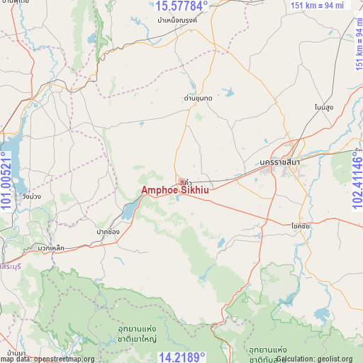
Amphoe Sikhiu GPS coordinates[2]
14° 53' 57.984" North, 101° 42' 29.988" East
| Map corner | latitude | longitude |
|---|---|---|
| Upper-left | 15.57784°, | 101.00521° |
| Center: | 14.89944°, | 101.70833° |
| Lower-right: | 14.2189°, | 102.41146° |
| Map W x H: | 151.1×151.1 km | = 93.9×93.9mi |
| max Lat: | 20.43353° ⇑51.6% North |
| Amphoe Sikhiu: | 14.89944° |
| min Lat: | ⇓48.4% South 5.77434° |
| min Long | Amphoe Sikhiu | max Long |
| 97.93288° | 101.70833° | 105.49506° |
| W 63.5%⇐ | ⇒36.5% E |
Elevation
Elevation of Amphoe Sikhiu is 232 m = 761 ft, and this is 106.5 m = 349 ft above average elevation for this country.
| Max E: |
1011 m = 3317 ft | 13.1% |
| Amphoe Sikhiu | 232 m 761 ft | |
| Avg. | 125.5 m = 412 ft | |
Min E: |
1 m = 3 ft | 86.9% |
See also: Thailand elevation on elevation.city.
Geographical zone
Amphoe Sikhiu is located in North Torrid zone (between Equator and Tropic of Cancer). Distance of this Northern Tropic circle is 949.3 km =589.9 mi to North.| Distance of | km | miles | from Amphoe Sikhiu |
|---|---|---|---|
| North Pole | 8350.4 | 5188.7 | to North |
| Arctic Circle | 5744.5 | 3569.5 | to North |
| Tropic Cancer | 949.3 | 589.9 | to North |
| Equator | 1656.7 | 1029.4 | to South |


Nearby cities:
15 places around Amphoe Sikhiu: (largest is in red/bold)
• Chok Chai
52.7 km =32.7 mi,  111°
111°
• Dan Khun Thot
35 km =21.7 mi,  11°
11°
• Kham Thale So
26.6 km =16.5 mi,  75°
75°
• Lam Sonthi
58 km =36 mi,  320°
320°
• Muak Lek
61.1 km =38 mi,  243°
243°
• Nakhon Ratchasima
43 km =26.7 mi, 79°
• Non Thai
51.1 km =31.8 mi,  49°
49°
• Pak Chong
37.9 km =23.5 mi, 235°
• Pak Thong Chai
39.3 km =24.4 mi,  120°
120°
• Phra Thong Kham
52.8 km =32.8 mi,  39°
39°
• Sikhio
1.8 km =1.1 mi, 116°
• Sung Noen
12.1 km =7.5 mi,  90°
90°
• Thep Sathit
61.4 km =38.2 mi,  333°
333°
• Thepharak
48.6 km =30.2 mi,  339°
339°
• Wang Nam Khiao
56 km =34.8 mi,  162°
162°
Sources, notices
• [Note1] Compared only with cities in Thailand existing in our database
• [Src1] Map data: © OpenStreetMap contributors (CC-BY-SA)
• [Src2] Other city data from geonames.org with taken over terms of usage.
• [Src3] Geographical zone / Annual Mean Temperature by Robert A. Rohde @ Wikipedia
