Dan Khun Thot geodata
Dan Khun Thot (Nakhon Ratchasima) is a seat of a second-order administrative division; located in Thailand in Asia/Bangkok (GMT+7) time zone. With population of 15,580 people, there are 209 cities with bigger population in this country. Compared to other cities in Thailand, 53% of cities are located further ↓South; 64.3% of cities are located further ←West and 84.5% of cities have lower elevation than Dan Khun Thot. Note1


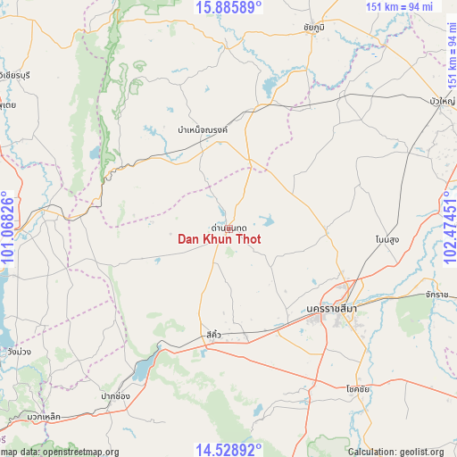
Dan Khun Thot GPS coordinates[2]
15° 12' 30.6" North, 101° 46' 16.968" East
| Map corner | latitude | longitude |
|---|---|---|
| Upper-left | 15.88589°, | 101.06826° |
| Center: | 15.2085°, | 101.77138° |
| Lower-right: | 14.52892°, | 102.47451° |
| Map W x H: | 150.9×150.9 km | = 93.8×93.8mi |
| max Lat: | 20.43353° ⇑47% North |
| Dan Khun Thot: | 15.2085° |
| min Lat: | ⇓53% South 5.77434° |
| min Long | Dan Khun Thot | max Long |
| 97.93288° | 101.77138° | 105.49506° |
| W 64.3%⇐ | ⇒35.7% E |
Elevation
Elevation of Dan Khun Thot is 214 m = 702 ft, and this is 88.5 m = 290 ft above average elevation for this country.
| Max E: |
1011 m = 3317 ft | 15.5% |
| Dan Khun Thot | 214 m 702 ft | |
| Avg. | 125.5 m = 412 ft | |
Min E: |
1 m = 3 ft | 84.5% |
See also: Thailand elevation on elevation.city.
Geographical zone
Dan Khun Thot is located in North Torrid zone (between Equator and Tropic of Cancer). Distance of this Northern Tropic circle is 914.9 km =568.5 mi to North.| Distance of | km | miles | from Dan Khun Thot |
|---|---|---|---|
| North Pole | 8316 | 5167.3 | to North |
| Arctic Circle | 5710.1 | 3548.1 | to North |
| Tropic Cancer | 914.9 | 568.5 | to North |
| Equator | 1691 | 1050.7 | to South |


Nearby cities:
15 places around Dan Khun Thot: (largest is in red/bold)
• Amphoe Sikhiu
35 km =21.7 mi,  191°
191°
• Bamnet Narong
33.8 km =21 mi,  344°
344°
• Chatturat
40.5 km =25.2 mi,  11°
11°
• Kham Sakae Saeng
45.2 km =28.1 mi,  72°
72°
• Kham Thale So
33.4 km =20.8 mi,  145°
145°
• Lam Sonthi
44.9 km =27.9 mi,  283°
283°
• Nakhon Ratchasima
44.3 km =27.5 mi,  126°
126°
• Noen Sa-nga
46.6 km =29 mi,  31°
31°
• Non Thai
32.2 km =20 mi,  92°
92°
• Phra Thong Kham
27.5 km =17.1 mi,  76°
76°
• Sap Yai
50.5 km =31.4 mi, 340°
• Sikhio
35.5 km =22.1 mi, 188°
• Sung Noen
34.8 km =21.6 mi,  171°
171°
• Thep Sathit
40 km =24.9 mi,  300°
300°
• Thepharak
26.2 km =16.3 mi, 295°
Sources, notices
• [Note1] Compared only with cities in Thailand existing in our database
• [Src1] Map data: © OpenStreetMap contributors (CC-BY-SA)
• [Src2] Other city data from geonames.org with taken over terms of usage.
• [Src3] Geographical zone / Annual Mean Temperature by Robert A. Rohde @ Wikipedia
