Lam Sonthi geodata
Lam Sonthi (Lop Buri) is a seat of a second-order administrative division; located in Thailand in Asia/Bangkok (GMT+7) time zone. In our database, there are 331 cities with bigger population. Compared to other cities in Thailand, 54.8% of cities are located further ↓South; 59.7% of cities are located further ←West and 50.9% of cities have higher elevation than Lam Sonthi. Note1


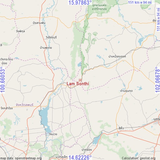
Lam Sonthi GPS coordinates[2]
15° 18' 5.544" North, 101° 21' 49.14" East
| Map corner | latitude | longitude |
|---|---|---|
| Upper-left | 15.97863°, | 100.66053° |
| Center: | 15.30154°, | 101.36365° |
| Lower-right: | 14.62226°, | 102.06678° |
| Map W x H: | 150.8×150.8 km | = 93.7×93.7mi |
| max Lat: | 20.43353° ⇑45.2% North |
| Lam Sonthi: | 15.30154° |
| min Lat: | ⇓54.8% South 5.77434° |
| min Long | Lam Sonthi | max Long |
| 97.93288° | 101.36365° | 105.49506° |
| W 59.7%⇐ | ⇒40.3% E |
Elevation
Elevation of Lam Sonthi is 85 m = 279 ft, and this is 40.5 m = 133 ft below average elevation for this country.
| Max E: |
1011 m = 3317 ft | 50.9% |
| Avg. | 125.5 m = 412 ft | |
| Lam Sonthi | 85 m = 279 ft | |
Min E: |
1 m = 3 ft | 49.1% |
See also: Thailand elevation on elevation.city.
Geographical zone
Lam Sonthi is located in North Torrid zone (between Equator and Tropic of Cancer). Distance of this Northern Tropic circle is 904.5 km =562 mi to North.| Distance of | km | miles | from Lam Sonthi |
|---|---|---|---|
| North Pole | 8305.7 | 5160.9 | to North |
| Arctic Circle | 5699.8 | 3541.7 | to North |
| Tropic Cancer | 904.5 | 562 | to North |
| Equator | 1701.4 | 1057.2 | to South |


Nearby cities:
15 places around Lam Sonthi: (largest is in red/bold)
• Amphoe Sikhiu
58 km =36 mi,  140°
140°
• Bamnet Narong
41.5 km =25.8 mi,  57°
57°
• Chai Badan
27.2 km =16.9 mi,  245°
245°
• Chatturat
59.4 km =36.9 mi, 60°
• Dan Khun Thot
44.9 km =27.9 mi,  103°
103°
• Khok Charoen
59.1 km =36.7 mi,  278°
278°
• Sa Bot
58.1 km =36.1 mi,  259°
259°
• Sap Yai
46.2 km =28.7 mi,  35°
35°
• Si Thep
36 km =22.4 mi,  297°
297°
• Sikhio
59.7 km =37.1 mi, 139°
• Tha Luang
38.3 km =23.8 mi,  228°
228°
• Thep Sathit
13.8 km =8.6 mi, 42°
• Thepharak
20 km =12.4 mi,  87°
87°
• Wang Muang
57.1 km =35.5 mi,  206°
206°
• Wichian Buri
48.3 km =30 mi,  325°
325°
Sources, notices
• [Note1] Compared only with cities in Thailand existing in our database
• [Src1] Map data: © OpenStreetMap contributors (CC-BY-SA)
• [Src2] Other city data from geonames.org with taken over terms of usage.
• [Src3] Geographical zone / Annual Mean Temperature by Robert A. Rohde @ Wikipedia
