Wang Wiset geodata
Wang Wiset (Trang) is a seat of a second-order administrative division; located in Thailand in Asia/Bangkok (GMT+7) time zone. In our database, there are 331 cities with bigger population. Compared to other cities in Thailand, 91.8% of cities are located further ↑North; 86.5% of cities are located further →East and 63.6% of cities have higher elevation than Wang Wiset. Note1


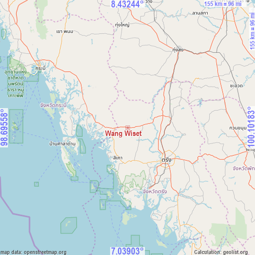
Wang Wiset GPS coordinates[2]
7° 44' 10.716" North, 99° 23' 55.32" East
| Map corner | latitude | longitude |
|---|---|---|
| Upper-left | 8.43244°, | 98.69558° |
| Center: | 7.73631°, | 99.3987° |
| Lower-right: | 7.03903°, | 100.10183° |
| Map W x H: | 154.9×154.9 km | = 96.3×96.3mi |
| max Lat: | 20.43353° ⇑91.8% North |
| Wang Wiset: | 7.73631° |
| min Lat: | ⇓8.2% South 5.77434° |
| min Long | Wang Wiset | max Long |
| 97.93288° | 99.3987° | 105.49506° |
| W 13.5%⇐ | ⇒86.5% E |
Elevation
Elevation of Wang Wiset is 35 m = 115 ft, and this is 90.5 m = 297 ft below average elevation for this country.
| Max E: |
1011 m = 3317 ft | 63.6% |
| Avg. | 125.5 m = 412 ft | |
| Wang Wiset | 35 m = 115 ft | |
Min E: |
1 m = 3 ft | 36.4% |
See also: Thailand elevation on elevation.city.
Geographical zone
Wang Wiset is located in North Torrid zone (between Equator and Tropic of Cancer). Distance of Equator is 860.2 km =534.5 mi to South.| Distance of | km | miles | from Wang Wiset |
|---|---|---|---|
| North Pole | 9146.9 | 5683.6 | to North |
| Arctic Circle | 6541 | 4064.4 | to North |
| Tropic Cancer | 1745.7 | 1084.7 | to North |
| Equator | 860.2 | 534.5 | to South |


Nearby cities:
15 places around Wang Wiset: (largest is in red/bold)
• Bang Khan
33.3 km =20.7 mi,  14°
14°
• Huai Yot
26.7 km =16.6 mi,  77°
77°
• Kantang
39 km =24.2 mi,  160°
160°
• Khlong Thom
35.8 km =22.2 mi,  308°
308°
• Ko Lanta
41.1 km =25.5 mi,  236°
236°
• Lam Thap
39.2 km =24.4 mi,  342°
342°
• Na Yong
38 km =23.6 mi,  120°
120°
• Nuea Khlong
57.6 km =35.8 mi, 310°
• Ratsada
37 km =23 mi,  44°
44°
• Saladan
42.2 km =26.2 mi,  251°
251°
• Si Banphot
53.5 km =33.2 mi,  91°
91°
• Sikao
19.3 km =12 mi,  197°
197°
• Thung Song
56.8 km =35.3 mi,  33°
33°
• Trang
30.8 km =19.1 mi,  130°
130°
• Yan Ta Khao
48.9 km =30.4 mi,  142°
142°
Sources, notices
• [Note1] Compared only with cities in Thailand existing in our database
• [Src1] Map data: © OpenStreetMap contributors (CC-BY-SA)
• [Src2] Other city data from geonames.org with taken over terms of usage.
• [Src3] Geographical zone / Annual Mean Temperature by Robert A. Rohde @ Wikipedia
