Phop Phra geodata
Phop Phra (Tak) is a seat of a second-order administrative division; located in Thailand in Asia/Bangkok (GMT+7) time zone. In our database, there are 331 cities with bigger population. Compared to other cities in Thailand, 70.5% of cities are located further ↓South; 94.8% of cities are located further →East and 94% of cities have lower elevation than Phop Phra. Note1


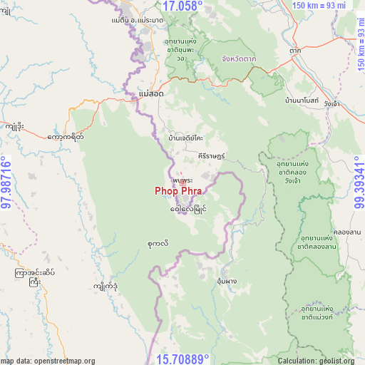
Phop Phra GPS coordinates[2]
16° 23' 4.596" North, 98° 41' 25.008" East
| Map corner | latitude | longitude |
|---|---|---|
| Upper-left | 17.058°, | 97.98716° |
| Center: | 16.38461°, | 98.69028° |
| Lower-right: | 15.70889°, | 99.39341° |
| Map W x H: | 150×150 km | = 93.2×93.2mi |
| max Lat: | 20.43353° ⇑29.5% North |
| Phop Phra: | 16.38461° |
| min Lat: | ⇓70.5% South 5.77434° |
| min Long | Phop Phra | max Long |
| 97.93288° | 98.69028° | 105.49506° |
| W 5.2%⇐ | ⇒94.8% E |
Elevation
Elevation of Phop Phra is 370 m = 1214 ft, and this is 244.5 m = 802 ft above average elevation for this country.
| Max E: |
1011 m = 3317 ft | 6% |
| Phop Phra | 370 m 1214 ft | |
| Avg. | 125.5 m = 412 ft | |
Min E: |
1 m = 3 ft | 94% |
See also: Thailand elevation on elevation.city.
Geographical zone
Phop Phra is located in North Torrid zone (between Equator and Tropic of Cancer). Distance of this Northern Tropic circle is 784.1 km =487.2 mi to North.| Distance of | km | miles | from Phop Phra |
|---|---|---|---|
| North Pole | 8185.3 | 5086.1 | to North |
| Arctic Circle | 5579.4 | 3466.9 | to North |
| Tropic Cancer | 784.1 | 487.2 | to North |
| Equator | 1821.8 | 1132 | to South |


Nearby cities:
15 places around Phop Phra: (largest is in red/bold)
• Ban Tak
84.2 km =52.3 mi,  29°
29°
• Kamphaeng Phet
89.3 km =55.5 mi,  82°
82°
• Khlong Khlung
111.4 km =69.2 mi,  99°
99°
• Khlong Lan
70.2 km =43.6 mi,  106°
106°
• Kosamphi Nakhon
75.5 km =46.9 mi,  68°
68°
• Mae Ramat
69.2 km =43 mi,  344°
344°
• Mae Sot
39.2 km =24.4 mi, 340°
• Mae Wong
111 km =69 mi,  127°
127°
• Pang Sila Thong
91.1 km =56.6 mi, 110°
• Phran Kratai
100.7 km =62.6 mi, 71°
• Sam Ngao
101.8 km =63.3 mi,  20°
20°
• Tak
71.4 km =44.4 mi,  40°
40°
• Tha Song Yang
105.9 km =65.8 mi,  332°
332°
• Umphang
44.9 km =27.9 mi,  155°
155°
• Wang Chao
69.6 km =43.2 mi,  62°
62°
Sources, notices
• [Note1] Compared only with cities in Thailand existing in our database
• [Src1] Map data: © OpenStreetMap contributors (CC-BY-SA)
• [Src2] Other city data from geonames.org with taken over terms of usage.
• [Src3] Geographical zone / Annual Mean Temperature by Robert A. Rohde @ Wikipedia
