Umphang geodata
Umphang (Tak) is a seat of a second-order administrative division; located in Thailand in Asia/Bangkok (GMT+7) time zone. In our database, there are 331 cities with bigger population. Compared to other cities in Thailand, 65.3% of cities are located further ↓South; 93.4% of cities are located further →East and 97.4% of cities have lower elevation than Umphang. Note1


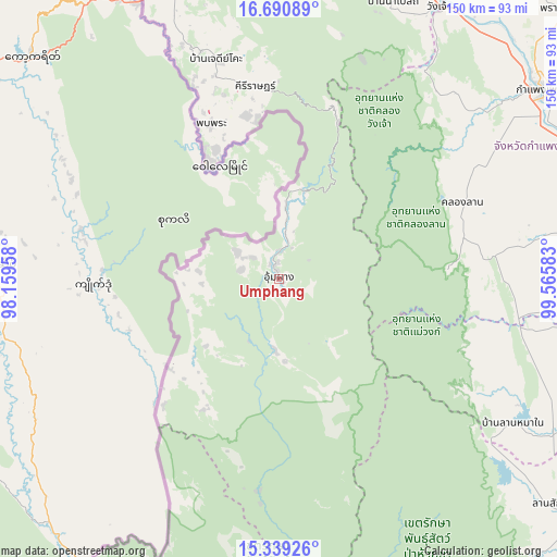
Umphang GPS coordinates[2]
16° 0' 58.392" North, 98° 51' 45.72" East
| Map corner | latitude | longitude |
|---|---|---|
| Upper-left | 16.69089°, | 98.15958° |
| Center: | 16.01622°, | 98.8627° |
| Lower-right: | 15.33926°, | 99.56583° |
| Map W x H: | 150.3×150.3 km | = 93.4×93.4mi |
| max Lat: | 20.43353° ⇑34.7% North |
| Umphang: | 16.01622° |
| min Lat: | ⇓65.3% South 5.77434° |
| min Long | Umphang | max Long |
| 97.93288° | 98.8627° | 105.49506° |
| W 6.6%⇐ | ⇒93.4% E |
Elevation
Elevation of Umphang is 461 m = 1512 ft, and this is 335.5 m = 1101 ft above average elevation for this country.
| Max E: |
1011 m = 3317 ft | 2.6% |
| Umphang | 461 m 1512 ft | |
| Avg. | 125.5 m = 412 ft | |
Min E: |
1 m = 3 ft | 97.4% |
See also: Thailand elevation on elevation.city.
Geographical zone
Umphang is located in North Torrid zone (between Equator and Tropic of Cancer). Distance of this Northern Tropic circle is 825.1 km =512.7 mi to North.| Distance of | km | miles | from Umphang |
|---|---|---|---|
| North Pole | 8226.2 | 5111.5 | to North |
| Arctic Circle | 5620.3 | 3492.3 | to North |
| Tropic Cancer | 825.1 | 512.7 | to North |
| Equator | 1780.8 | 1106.5 | to South |


Nearby cities:
15 places around Umphang: (largest is in red/bold)
• Chum Ta Bong
85.3 km =53 mi,  120°
120°
• Kamphaeng Phet
87.4 km =54.3 mi,  53°
53°
• Khlong Khlung
94.1 km =58.5 mi,  76°
76°
• Khlong Lan
53.1 km =33 mi,  66°
66°
• Kosamphi Nakhon
85.9 km =53.4 mi,  37°
37°
• Lan Sak
98.8 km =61.4 mi,  129°
129°
• Lat Yao
103.4 km =64.2 mi,  106°
106°
• Mae Poen
76.2 km =47.3 mi, 121°
• Mae Sot
84 km =52.2 mi,  337°
337°
• Mae Wong
74.8 km =46.5 mi, 110°
• Pang Sila Thong
67.5 km =41.9 mi, 82°
• Phop Phra
44.9 km =27.9 mi, 335°
• Sangkhla Buri
105.3 km =65.4 mi,  204°
204°
• Tak
99.1 km =61.6 mi,  16°
16°
• Wang Chao
85.1 km =52.9 mi,  30°
30°
Sources, notices
• [Note1] Compared only with cities in Thailand existing in our database
• [Src1] Map data: © OpenStreetMap contributors (CC-BY-SA)
• [Src2] Other city data from geonames.org with taken over terms of usage.
• [Src3] Geographical zone / Annual Mean Temperature by Robert A. Rohde @ Wikipedia
