Phanom Thuan geodata
Phanom Thuan (Kanchanaburi) is a seat of a second-order administrative division; located in Thailand in Asia/Bangkok (GMT+7) time zone. With population of 12,469 people, there are 257 cities with bigger population in this country. Compared to other cities in Thailand, 63.2% of cities are located further ↑North; 80.8% of cities are located further →East and 72.3% of cities have higher elevation than Phanom Thuan. Note1


Phanom Thuan GPS coordinates[2]
14° 7' 49.116" North, 99° 41' 54.888" East
| Map corner | latitude | longitude |
|---|---|---|
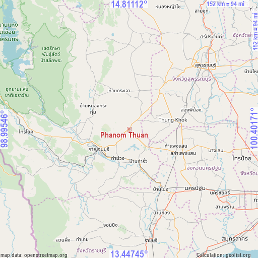
| Upper-left | 14.81112°, | 98.99546° |
| Center: | 14.13031°, | 99.69858° |
| Lower-right: | 13.44745°, | 100.40171° |
| Map W x H: | 151.6×151.6 km | = 94.2×94.2mi |
| max Lat: | 20.43353° ⇑63.2% North |
| Phanom Thuan: | 14.13031° |
| min Lat: | ⇓36.8% South 5.77434° |
| min Long | Phanom Thuan | max Long |
| 97.93288° | 99.69858° | 105.49506° |
| W 19.2%⇐ | ⇒80.8% E |
Elevation
Elevation of Phanom Thuan is 19 m = 62 ft, and this is 106.5 m = 349 ft below average elevation for this country.
| Max E: |
1011 m = 3317 ft | 72.3% |
| Avg. | 125.5 m = 412 ft | |
| Phanom Thuan | 19 m = 62 ft | |
Min E: |
1 m = 3 ft | 27.7% |
See also: Thailand elevation on elevation.city.
Geographical zone
Phanom Thuan is located in North Torrid zone (between Equator and Tropic of Cancer). Distance of this Northern Tropic circle is 1034.8 km =643 mi to North.| Distance of | km | miles | from Phanom Thuan |
|---|---|---|---|
| North Pole | 8435.9 | 5241.8 | to North |
| Arctic Circle | 5830 | 3622.6 | to North |
| Tropic Cancer | 1034.8 | 643 | to North |
| Equator | 1571.1 | 976.2 | to South |


Nearby cities:
15 places around Phanom Thuan: (largest is in red/bold)
• Ban Pong
39.9 km =24.8 mi,  151°
151°
• Bo Phloi
29.4 km =18.3 mi,  317°
317°
• Dan Makham Tia
43.8 km =27.2 mi,  225°
225°
• Don Tum
45.1 km =28 mi,  114°
114°
• Huai Krachao
22.2 km =13.8 mi,  351°
351°
• Kamphaeng Saen
34.6 km =21.5 mi, 114°
• Kanchanaburi
21.4 km =13.3 mi, 229°
• Lao Khwan
52.3 km =32.5 mi,  8°
8°
• Nakhon Pathom
50.8 km =31.6 mi,  132°
132°
• Photharam
51.4 km =31.9 mi,  161°
161°
• Song Phi Nong
36.3 km =22.6 mi,  73°
73°
• Tha Maka
24.4 km =15.2 mi, 162°
• Tha Maka
26.6 km =16.5 mi, 163°
• Tha Muang
19.8 km =12.3 mi,  198°
198°
• U Thong
34.3 km =21.3 mi,  37°
37°
Sources, notices
• [Note1] Compared only with cities in Thailand existing in our database
• [Src1] Map data: © OpenStreetMap contributors (CC-BY-SA)
• [Src2] Other city data from geonames.org with taken over terms of usage.
• [Src3] Geographical zone / Annual Mean Temperature by Robert A. Rohde @ Wikipedia
