Huai Krachao geodata
Huai Krachao (Kanchanaburi) is a seat of a second-order administrative division; located in Thailand in Asia/Bangkok (GMT+7) time zone. In our database, there are 331 cities with bigger population. Compared to other cities in Thailand, 61.9% of cities are located further ↑North; 81.5% of cities are located further →East and 52.5% of cities have higher elevation than Huai Krachao. Note1


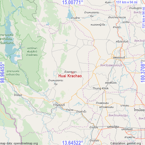
Huai Krachao GPS coordinates[2]
14° 19' 39" North, 99° 40' 3.612" East
| Map corner | latitude | longitude |
|---|---|---|
| Upper-left | 15.00771°, | 98.96455° |
| Center: | 14.3275°, | 99.66767° |
| Lower-right: | 13.64522°, | 100.3708° |
| Map W x H: | 151.5×151.5 km | = 94.1×94.1mi |
| max Lat: | 20.43353° ⇑61.9% North |
| Huai Krachao: | 14.3275° |
| min Lat: | ⇓38.1% South 5.77434° |
| min Long | Huai Krachao | max Long |
| 97.93288° | 99.66767° | 105.49506° |
| W 18.5%⇐ | ⇒81.5% E |
Elevation
Elevation of Huai Krachao is 69 m = 226 ft, and this is 56.5 m = 185 ft below average elevation for this country.
| Max E: |
1011 m = 3317 ft | 52.5% |
| Avg. | 125.5 m = 412 ft | |
| Huai Krachao | 69 m = 226 ft | |
Min E: |
1 m = 3 ft | 47.5% |
See also: Thailand elevation on elevation.city.
Geographical zone
Huai Krachao is located in North Torrid zone (between Equator and Tropic of Cancer). Distance of this Northern Tropic circle is 1012.9 km =629.4 mi to North.| Distance of | km | miles | from Huai Krachao |
|---|---|---|---|
| North Pole | 8414 | 5228.2 | to North |
| Arctic Circle | 5808.1 | 3609 | to North |
| Tropic Cancer | 1012.9 | 629.4 | to North |
| Equator | 1593.1 | 989.9 | to South |


Nearby cities:
15 places around Huai Krachao: (largest is in red/bold)
• Bang Pla Ma
53.4 km =33.2 mi,  81°
81°
• Bo Phloi
16.5 km =10.3 mi,  269°
269°
• Don Chedi
51.1 km =31.8 mi,  48°
48°
• Kamphaeng Saen
50.3 km =31.3 mi,  136°
136°
• Kanchanaburi
38.2 km =23.7 mi,  199°
199°
• Lao Khwan
31.9 km =19.8 mi,  21°
21°
• Nong Prue
38.5 km =23.9 mi,  324°
324°
• Nong Yasai
56.7 km =35.2 mi,  27°
27°
• Phanom Thuan
22.2 km =13.8 mi,  171°
171°
• Song Phi Nong
39.8 km =24.7 mi,  106°
106°
• Suphan Buri
51.6 km =32.1 mi,  71°
71°
• Tha Maka
46.4 km =28.8 mi, 166°
• Tha Maka
48.7 km =30.3 mi, 167°
• Tha Muang
40.8 km =25.4 mi,  184°
184°
• U Thong
24.8 km =15.4 mi, 77°
Sources, notices
• [Note1] Compared only with cities in Thailand existing in our database
• [Src1] Map data: © OpenStreetMap contributors (CC-BY-SA)
• [Src2] Other city data from geonames.org with taken over terms of usage.
• [Src3] Geographical zone / Annual Mean Temperature by Robert A. Rohde @ Wikipedia
