Sop Pong geodata
Sop Pong (Mae Hong Son) is a seat of a second-order administrative division; located in Thailand in Asia/Bangkok (GMT+7) time zone. In our database, there are 331 cities with bigger population. Compared to other cities in Thailand, 97.5% of cities are located further ↓South; 99.2% of cities are located further →East and 98.8% of cities have lower elevation than Sop Pong. Note1


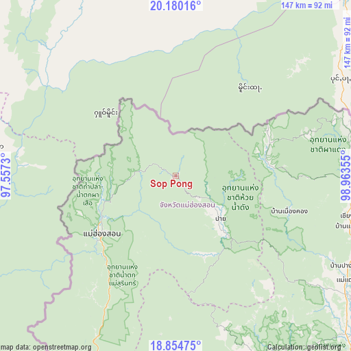
Sop Pong GPS coordinates[2]
19° 31' 7.716" North, 98° 15' 37.512" East
| Map corner | latitude | longitude |
|---|---|---|
| Upper-left | 20.18016°, | 97.5573° |
| Center: | 19.51881°, | 98.26042° |
| Lower-right: | 18.85475°, | 98.96355° |
| Map W x H: | 147.4×147.4 km | = 91.6×91.6mi |
| max Lat: | 20.43353° ⇑2.5% North |
| Sop Pong: | 19.51881° |
| min Lat: | ⇓97.5% South 5.77434° |
| min Long | Sop Pong | max Long |
| 97.93288° | 98.26042° | 105.49506° |
| W 0.8%⇐ | ⇒99.2% E |
Elevation
Elevation of Sop Pong is 607 m = 1991 ft, and this is 481.5 m = 1580 ft above average elevation for this country.
| Max E: |
1011 m = 3317 ft | 1.2% |
| Sop Pong | 607 m 1991 ft | |
| Avg. | 125.5 m = 412 ft | |
Min E: |
1 m = 3 ft | 98.8% |
See also: Thailand elevation on elevation.city.
Geographical zone
Sop Pong is located in North Torrid zone (between Equator and Tropic of Cancer). Distance of this Northern Tropic circle is 435.6 km =270.7 mi to North.| Distance of | km | miles | from Sop Pong |
|---|---|---|---|
| North Pole | 7836.8 | 4869.6 | to North |
| Arctic Circle | 5230.9 | 3250.3 | to North |
| Tropic Cancer | 435.6 | 270.7 | to North |
| Equator | 2170.3 | 1348.6 | to South |


Nearby cities:
15 places around Sop Pong: (largest is in red/bold)
• Chaem Luang
54.2 km =33.7 mi,  176°
176°
• Chai Prakan
95.1 km =59.1 mi,  75°
75°
• Chiang Dao
75.8 km =47.1 mi,  103°
103°
• Chiang Mai
111.1 km =69 mi,  136°
136°
• Fang
109.2 km =67.9 mi,  66°
66°
• Khun Yuam
84 km =52.2 mi,  204°
204°
• Mae Hi
27.9 km =17.3 mi,  134°
134°
• Mae Hong Son
39.1 km =24.3 mi,  231°
231°
• Mae Taeng
84.3 km =52.4 mi,  121°
121°
• Pai
25.7 km =16 mi, 132°
• Phrao
100.2 km =62.3 mi, 99°
• Samoeng
89.5 km =55.6 mi,  146°
146°
• San Sai
111.2 km =69.1 mi, 132°
• Wiang Haeng
40.3 km =25 mi, 83°
• Wiang Nuea
24.9 km =15.5 mi, 128°
Sources, notices
• [Note1] Compared only with cities in Thailand existing in our database
• [Src1] Map data: © OpenStreetMap contributors (CC-BY-SA)
• [Src2] Other city data from geonames.org with taken over terms of usage.
• [Src3] Geographical zone / Annual Mean Temperature by Robert A. Rohde @ Wikipedia
