Mae Hong Son geodata
Mae Hong Son is a seat of a first-order administrative division; located in Thailand in Asia/Bangkok (GMT+7) time zone. With population of 9,109 people, there are 289 cities with bigger population in this country. Compared to other cities in Thailand, 96.3% of cities are located further ↓South; 99.7% of cities are located further →East and 88.8% of cities have lower elevation than Mae Hong Son. Note1


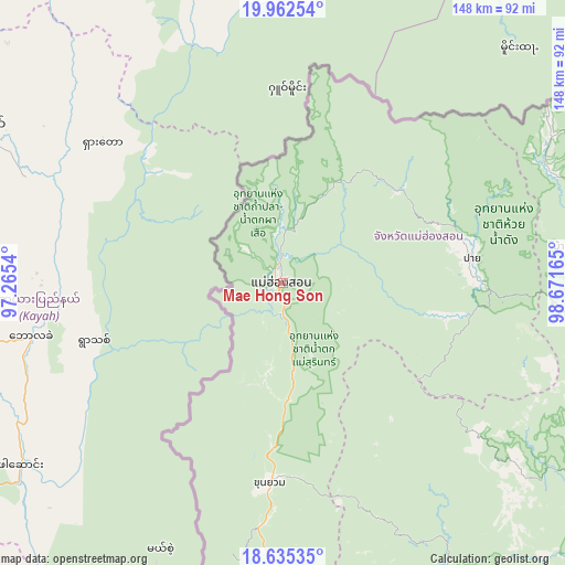
Mae Hong Son GPS coordinates[2]
19° 18' 1.044" North, 97° 58' 6.672" East
| Map corner | latitude | longitude |
|---|---|---|
| Upper-left | 19.96254°, | 97.2654° |
| Center: | 19.30029°, | 97.96852° |
| Lower-right: | 18.63535°, | 98.67165° |
| Map W x H: | 147.6×147.6 km | = 91.7×91.7mi |
| max Lat: | 20.43353° ⇑3.7% North |
| Mae Hong Son: | 19.30029° |
| min Lat: | ⇓96.3% South 5.77434° |
| min Long | Mae Hong Son | max Long |
| 97.93288° | 97.96852° | 105.49506° |
| W 0.3%⇐ | ⇒99.7% E |
Elevation
Elevation of Mae Hong Son is 258 m = 846 ft, and this is 132.5 m = 435 ft above average elevation for this country.
| Max E: |
1011 m = 3317 ft | 11.2% |
| Mae Hong Son | 258 m 846 ft | |
| Avg. | 125.5 m = 412 ft | |
Min E: |
1 m = 3 ft | 88.8% |
See also: Thailand elevation on elevation.city.
Geographical zone
Mae Hong Son is located in North Torrid zone (between Equator and Tropic of Cancer). Distance of this Northern Tropic circle is 459.9 km =285.8 mi to North.| Distance of | km | miles | from Mae Hong Son |
|---|---|---|---|
| North Pole | 7861.1 | 4884.7 | to North |
| Arctic Circle | 5255.2 | 3265.4 | to North |
| Tropic Cancer | 459.9 | 285.8 | to North |
| Equator | 2146 | 1333.5 | to South |


Nearby cities:
15 places around Mae Hong Son: (largest is in red/bold)
• Ban Pa Pae
113.4 km =70.5 mi,  175°
175°
• Chaem Luang
44.9 km =27.9 mi,  131°
131°
• Chiang Dao
104.8 km =65.1 mi,  86°
86°
• Chiang Mai
120.9 km =75.1 mi,  117°
117°
• Khun Yuam
52.5 km =32.6 mi, 184°
• Mae Chaem
98.3 km =61.1 mi,  154°
154°
• Mae Hi
50.8 km =31.6 mi,  84°
84°
• Mae La Noi
102.2 km =63.5 mi, 181°
• Mae Taeng
104.2 km =64.7 mi,  101°
101°
• Mae Wang
113.8 km =70.7 mi, 131°
• Pai
49.9 km =31 mi, 82°
• Samoeng
94.7 km =58.8 mi, 122°
• Sop Pong
39.1 km =24.3 mi,  51°
51°
• Wiang Haeng
76.2 km =47.3 mi,  68°
68°
• Wiang Nuea
50.9 km =31.6 mi, 80°
Sources, notices
• [Note1] Compared only with cities in Thailand existing in our database
• [Src1] Map data: © OpenStreetMap contributors (CC-BY-SA)
• [Src2] Other city data from geonames.org with taken over terms of usage.
• [Src3] Geographical zone / Annual Mean Temperature by Robert A. Rohde @ Wikipedia
