Ko Pha Ngan geodata
Ko Pha Ngan (Surat Thani) is a seat of a second-order administrative division; located in Thailand in Asia/Bangkok (GMT+7) time zone. In our database, there are 331 cities with bigger population. Compared to other cities in Thailand, 83.5% of cities are located further ↑North; 72.5% of cities are located further →East and 88.1% of cities have higher elevation than Ko Pha Ngan. Note1


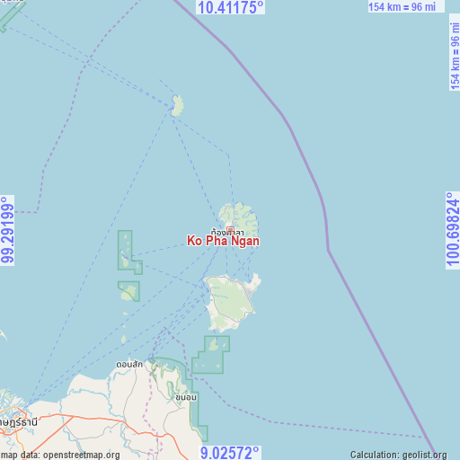
Ko Pha Ngan GPS coordinates[2]
9° 43' 10.02" North, 99° 59' 42.396" East
| Map corner | latitude | longitude |
|---|---|---|
| Upper-left | 10.41175°, | 99.29199° |
| Center: | 9.71945°, | 99.99511° |
| Lower-right: | 9.02572°, | 100.69824° |
| Map W x H: | 154.1×154.1 km | = 95.8×95.8mi |
| max Lat: | 20.43353° ⇑83.5% North |
| Ko Pha Ngan: | 9.71945° |
| min Lat: | ⇓16.5% South 5.77434° |
| min Long | Ko Pha Ngan | max Long |
| 97.93288° | 99.99511° | 105.49506° |
| W 27.5%⇐ | ⇒72.5% E |
Elevation
Elevation of Ko Pha Ngan is 9 m = 30 ft, and this is 116.5 m = 382 ft below average elevation for this country.
| Max E: |
1011 m = 3317 ft | 88.1% |
| Avg. | 125.5 m = 412 ft | |
| Ko Pha Ngan | 9 m = 30 ft | |
Min E: |
1 m = 3 ft | 11.9% |
See also: Thailand elevation on elevation.city.
Geographical zone
Ko Pha Ngan is located in North Torrid zone (between Equator and Tropic of Cancer). Distance of Equator is 1080.7 km =671.5 mi to South.| Distance of | km | miles | from Ko Pha Ngan |
|---|---|---|---|
| North Pole | 8926.4 | 5546.6 | to North |
| Arctic Circle | 6320.5 | 3927.4 | to North |
| Tropic Cancer | 1525.2 | 947.7 | to North |
| Equator | 1080.7 | 671.5 | to South |


Nearby cities:
15 places around Ko Pha Ngan: (largest is in red/bold)
• Chaiya
94.9 km =59 mi,  247°
247°
• Don Sak
55.8 km =34.7 mi,  216°
216°
• Kanchanadit
84.3 km =52.4 mi, 223°
• Ko Pha Ngan
5.7 km =3.5 mi,  41°
41°
• Ko Samui
21.4 km =13.3 mi,  197°
197°
• Koh Tao
45.5 km =28.3 mi,  337°
337°
• Lamae
99.1 km =61.6 mi,  273°
273°
• Lang Suan
103.5 km =64.3 mi,  284°
284°
• Nopphitam
114.1 km =70.9 mi,  193°
193°
• Sawi
112.8 km =70.1 mi,  300°
300°
• Surat Thani
97.1 km =60.3 mi,  228°
228°
• Tha Chana
92.4 km =57.4 mi,  259°
259°
• Tha Chang
101.6 km =63.1 mi,  240°
240°
• Tha Kham
107.6 km =66.9 mi, 231°
• Thung Tako
108.9 km =67.7 mi,  293°
293°
Sources, notices
• [Note1] Compared only with cities in Thailand existing in our database
• [Src1] Map data: © OpenStreetMap contributors (CC-BY-SA)
• [Src2] Other city data from geonames.org with taken over terms of usage.
• [Src3] Geographical zone / Annual Mean Temperature by Robert A. Rohde @ Wikipedia
