Kut Chum geodata
Kut Chum (Yasothon) is a seat of a second-order administrative division; located in Thailand in Asia/Bangkok (GMT+7) time zone. In our database, there are 331 cities with bigger population. Compared to other cities in Thailand, 65.9% of cities are located further ↓South; 93.9% of cities are located further ←West and 64.7% of cities have lower elevation than Kut Chum. Note1


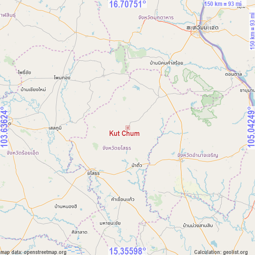
Kut Chum GPS coordinates[2]
16° 1' 58.404" North, 104° 20' 21.696" East
| Map corner | latitude | longitude |
|---|---|---|
| Upper-left | 16.70751°, | 103.63624° |
| Center: | 16.03289°, | 104.33936° |
| Lower-right: | 15.35598°, | 105.04249° |
| Map W x H: | 150.3×150.3 km | = 93.4×93.4mi |
| max Lat: | 20.43353° ⇑34.1% North |
| Kut Chum: | 16.03289° |
| min Lat: | ⇓65.9% South 5.77434° |
| min Long | Kut Chum | max Long |
| 97.93288° | 104.33936° | 105.49506° |
| W 93.9%⇐ | ⇒6.1% E |
Elevation
Elevation of Kut Chum is 159 m = 522 ft, and this is 33.5 m = 110 ft above average elevation for this country.
| Max E: |
1011 m = 3317 ft | 35.3% |
| Kut Chum | 159 m 522 ft | |
| Avg. | 125.5 m = 412 ft | |
Min E: |
1 m = 3 ft | 64.7% |
See also: Thailand elevation on elevation.city.
Geographical zone
Kut Chum is located in North Torrid zone (between Equator and Tropic of Cancer). Distance of this Northern Tropic circle is 823.2 km =511.5 mi to North.| Distance of | km | miles | from Kut Chum |
|---|---|---|---|
| North Pole | 8224.4 | 5110.4 | to North |
| Arctic Circle | 5618.5 | 3491.2 | to North |
| Tropic Cancer | 823.2 | 511.5 | to North |
| Equator | 1782.7 | 1107.7 | to South |


Nearby cities:
15 places around Kut Chum: (largest is in red/bold)
• Amnat Charoen
36.5 km =22.7 mi,  122°
122°
• Ban Selaphum
41.6 km =25.8 mi,  267°
267°
• Hua Taphan
40.7 km =25.3 mi,  156°
156°
• Kham Khuean Kaeo
42.4 km =26.3 mi,  184°
184°
• Loeng Nok Tha
30.1 km =18.7 mi,  49°
49°
• Moeiwadi
44.2 km =27.5 mi,  333°
333°
• Nikhom Kham Soi
44 km =27.3 mi,  31°
31°
• Nong Phok
34.1 km =21.2 mi, 334°
• Pa Tio
22.8 km =14.2 mi,  167°
167°
• Phanom Phrai
46.5 km =28.9 mi,  211°
211°
• Sai Mun
17.1 km =10.6 mi,  235°
235°
• Selaphum
42.9 km =26.7 mi, 269°
• Senangkhanikhom
35.3 km =21.9 mi,  88°
88°
• Thai Charoen
11.4 km =7.1 mi,  70°
70°
• Yasothon
33.7 km =20.9 mi,  218°
218°
Sources, notices
• [Note1] Compared only with cities in Thailand existing in our database
• [Src1] Map data: © OpenStreetMap contributors (CC-BY-SA)
• [Src2] Other city data from geonames.org with taken over terms of usage.
• [Src3] Geographical zone / Annual Mean Temperature by Robert A. Rohde @ Wikipedia
