Thai Charoen geodata
Thai Charoen (Yasothon) is a seat of a second-order administrative division; located in Thailand in Asia/Bangkok (GMT+7) time zone. In our database, there are 331 cities with bigger population. Compared to other cities in Thailand, 66.7% of cities are located further ↓South; 94.8% of cities are located further ←West and 74.3% of cities have lower elevation than Thai Charoen. Note1


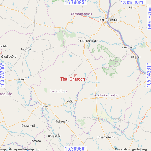
Thai Charoen GPS coordinates[2]
16° 3' 59.22" North, 104° 26' 24.648" East
| Map corner | latitude | longitude |
|---|---|---|
| Upper-left | 16.74095°, | 103.73706° |
| Center: | 16.06645°, | 104.44018° |
| Lower-right: | 15.38966°, | 105.14331° |
| Map W x H: | 150.2×150.3 km | = 93.3×93.4mi |
| max Lat: | 20.43353° ⇑33.3% North |
| Thai Charoen: | 16.06645° |
| min Lat: | ⇓66.7% South 5.77434° |
| min Long | Thai Charoen | max Long |
| 97.93288° | 104.44018° | 105.49506° |
| W 94.8%⇐ | ⇒5.2% E |
Elevation
Elevation of Thai Charoen is 181 m = 594 ft, and this is 55.5 m = 182 ft above average elevation for this country.
| Max E: |
1011 m = 3317 ft | 25.7% |
| Thai Charoen | 181 m 594 ft | |
| Avg. | 125.5 m = 412 ft | |
Min E: |
1 m = 3 ft | 74.3% |
See also: Thailand elevation on elevation.city.
Geographical zone
Thai Charoen is located in North Torrid zone (between Equator and Tropic of Cancer). Distance of this Northern Tropic circle is 819.5 km =509.2 mi to North.| Distance of | km | miles | from Thai Charoen |
|---|---|---|---|
| North Pole | 8220.6 | 5108 | to North |
| Arctic Circle | 5614.8 | 3488.9 | to North |
| Tropic Cancer | 819.5 | 509.2 | to North |
| Equator | 1786.4 | 1110 | to South |


Nearby cities:
15 places around Thai Charoen: (largest is in red/bold)
• Amnat Charoen
30.7 km =19.1 mi,  138°
138°
• Ban Selaphum
52.7 km =32.7 mi,  263°
263°
• Hua Taphan
41.4 km =25.7 mi,  172°
172°
• Kham Khuean Kaeo
48.1 km =29.9 mi,  196°
196°
• Kut Chum
11.4 km =7.1 mi,  250°
250°
• Loeng Nok Tha
19.9 km =12.4 mi,  38°
38°
• Lue Amnat
46.9 km =29.1 mi,  151°
151°
• Moeiwadi
46.9 km =29.1 mi,  319°
319°
• Nikhom Kham Soi
36 km =22.4 mi,  19°
19°
• Nong Phok
37.1 km =23.1 mi, 316°
• Nong Sung
47.4 km =29.5 mi,  347°
347°
• Pa Tio
26.6 km =16.5 mi,  192°
192°
• Sai Mun
28.2 km =17.5 mi,  241°
241°
• Senangkhanikhom
24.7 km =15.3 mi,  96°
96°
• Yasothon
43.7 km =27.2 mi,  226°
226°
Sources, notices
• [Note1] Compared only with cities in Thailand existing in our database
• [Src1] Map data: © OpenStreetMap contributors (CC-BY-SA)
• [Src2] Other city data from geonames.org with taken over terms of usage.
• [Src3] Geographical zone / Annual Mean Temperature by Robert A. Rohde @ Wikipedia
