Moeiwadi geodata
Moeiwadi (Roi Et) is a seat of a second-order administrative division; located in Thailand in Asia/Bangkok (GMT+7) time zone. With population of 5,609 people, there are 308 cities with bigger population in this country. Compared to other cities in Thailand, 70.7% of cities are located further ↓South; 92.4% of cities are located further ←West and 72.4% of cities have lower elevation than Moeiwadi. Note1


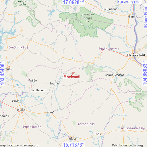
Moeiwadi GPS coordinates[2]
16° 23' 21.984" North, 104° 9' 25.92" East
| Map corner | latitude | longitude |
|---|---|---|
| Upper-left | 17.06281°, | 103.45408° |
| Center: | 16.38944°, | 104.1572° |
| Lower-right: | 15.71373°, | 104.86033° |
| Map W x H: | 150×150 km | = 93.2×93.2mi |
| max Lat: | 20.43353° ⇑29.3% North |
| Moeiwadi: | 16.38944° |
| min Lat: | ⇓70.7% South 5.77434° |
| min Long | Moeiwadi | max Long |
| 97.93288° | 104.1572° | 105.49506° |
| W 92.4%⇐ | ⇒7.6% E |
Elevation
Elevation of Moeiwadi is 176 m = 577 ft, and this is 50.5 m = 166 ft above average elevation for this country.
| Max E: |
1011 m = 3317 ft | 27.6% |
| Moeiwadi | 176 m 577 ft | |
| Avg. | 125.5 m = 412 ft | |
Min E: |
1 m = 3 ft | 72.4% |
See also: Thailand elevation on elevation.city.
Geographical zone
Moeiwadi is located in North Torrid zone (between Equator and Tropic of Cancer). Distance of this Northern Tropic circle is 783.6 km =486.9 mi to North.| Distance of | km | miles | from Moeiwadi |
|---|---|---|---|
| North Pole | 8184.7 | 5085.7 | to North |
| Arctic Circle | 5578.8 | 3466.5 | to North |
| Tropic Cancer | 783.6 | 486.9 | to North |
| Equator | 1822.3 | 1132.3 | to South |


Nearby cities:
15 places around Moeiwadi: (largest is in red/bold)
• Huai Phueng
39.2 km =24.4 mi,  317°
317°
• Khamcha-i
34.9 km =21.7 mi,  53°
53°
• Khao Wong
35.3 km =21.9 mi,  348°
348°
• Kuchinarai
20.4 km =12.7 mi,  325°
325°
• Kut Chum
44.2 km =27.5 mi,  153°
153°
• Na Khu
43.9 km =27.3 mi,  341°
341°
• Na Mon
44.6 km =27.7 mi,  297°
297°
• Nikhom Kham Soi
42.1 km =26.2 mi,  92°
92°
• Nong Phok
10.1 km =6.3 mi, 151°
• Nong Sung
22.8 km =14.2 mi,  62°
62°
• Pho Chai
41.8 km =26 mi,  260°
260°
• Rong Kham
45.8 km =28.5 mi,  253°
253°
• Selaphum
46.3 km =28.8 mi,  210°
210°
• Thai Charoen
46.9 km =29.1 mi,  139°
139°
• Waeng
21.6 km =13.4 mi,  242°
242°
Sources, notices
• [Note1] Compared only with cities in Thailand existing in our database
• [Src1] Map data: © OpenStreetMap contributors (CC-BY-SA)
• [Src2] Other city data from geonames.org with taken over terms of usage.
• [Src3] Geographical zone / Annual Mean Temperature by Robert A. Rohde @ Wikipedia
