Thong Saen Khan geodata
Thong Saen Khan (Uttaradit) is a seat of a second-order administrative division; located in Thailand in Asia/Bangkok (GMT+7) time zone. In our database, there are 331 cities with bigger population. Compared to other cities in Thailand, 83.6% of cities are located further ↓South; 63.3% of cities are located further →East and 51.1% of cities have higher elevation than Thong Saen Khan. Note1


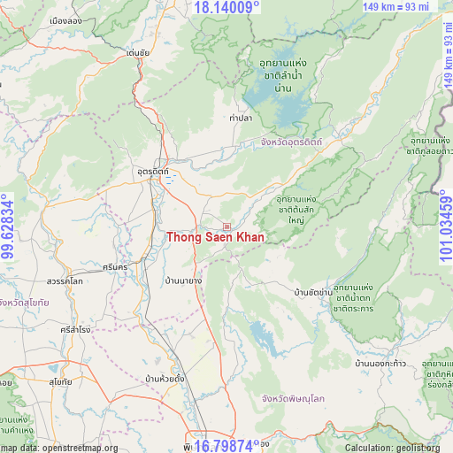
Thong Saen Khan GPS coordinates[2]
17° 28' 14.34" North, 100° 19' 53.256" East
| Map corner | latitude | longitude |
|---|---|---|
| Upper-left | 18.14009°, | 99.62834° |
| Center: | 17.47065°, | 100.33146° |
| Lower-right: | 16.79874°, | 101.03459° |
| Map W x H: | 149.1×149.1 km | = 92.6×92.6mi |
| max Lat: | 20.43353° ⇑16.4% North |
| Thong Saen Khan: | 17.47065° |
| min Lat: | ⇓83.6% South 5.77434° |
| min Long | Thong Saen Khan | max Long |
| 97.93288° | 100.33146° | 105.49506° |
| W 36.7%⇐ | ⇒63.3% E |
Elevation
Elevation of Thong Saen Khan is 83 m = 272 ft, and this is 42.5 m = 139 ft below average elevation for this country.
| Max E: |
1011 m = 3317 ft | 51.1% |
| Avg. | 125.5 m = 412 ft | |
| Thong Saen Khan | 83 m = 272 ft | |
Min E: |
1 m = 3 ft | 48.9% |
See also: Thailand elevation on elevation.city.
Geographical zone
Thong Saen Khan is located in North Torrid zone (between Equator and Tropic of Cancer). Distance of this Northern Tropic circle is 663.4 km =412.2 mi to North.| Distance of | km | miles | from Thong Saen Khan |
|---|---|---|---|
| North Pole | 8064.5 | 5011 | to North |
| Arctic Circle | 5458.6 | 3391.8 | to North |
| Tropic Cancer | 663.4 | 412.2 | to North |
| Equator | 1942.6 | 1207.1 | to South |


Nearby cities:
15 places around Thong Saen Khan: (largest is in red/bold)
• Chat Trakan
35.8 km =22.2 mi,  127°
127°
• Den Chai
64.3 km =40 mi,  332°
332°
• Lap Lae
37 km =23 mi,  303°
303°
• Laplae
37 km =23 mi, 303°
• Nam Pat
47.1 km =29.3 mi,  52°
52°
• Phichai
33 km =20.5 mi,  231°
231°
• Phrom Phiram
50.5 km =31.4 mi,  195°
195°
• Sawankhalok
55.7 km =34.6 mi,  252°
252°
• Si Nakhon
39.1 km =24.3 mi, 249°
• Si Samrong
60.4 km =37.5 mi,  235°
235°
• Si Satchanalai
60.8 km =37.8 mi,  274°
274°
• Tha Pla
35.9 km =22.3 mi,  7°
7°
• Tron
23.2 km =14.4 mi, 273°
• Uttaradit
30.5 km =19 mi, 304°
• Wat Bot
54.4 km =33.8 mi,  179°
179°
Sources, notices
• [Note1] Compared only with cities in Thailand existing in our database
• [Src1] Map data: © OpenStreetMap contributors (CC-BY-SA)
• [Src2] Other city data from geonames.org with taken over terms of usage.
• [Src3] Geographical zone / Annual Mean Temperature by Robert A. Rohde @ Wikipedia
