Sung Men geodata
Sung Men (Phrae) is a seat of a second-order administrative division; located in Thailand in Asia/Bangkok (GMT+7) time zone. In our database, there are 331 cities with bigger population. Compared to other cities in Thailand, 89.6% of cities are located further ↓South; 68.9% of cities are located further →East and 67.1% of cities have lower elevation than Sung Men. Note1


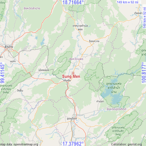
Sung Men GPS coordinates[2]
18° 2' 57.84" North, 100° 6' 52.452" East
| Map corner | latitude | longitude |
|---|---|---|
| Upper-left | 18.71664°, | 99.41145° |
| Center: | 18.0494°, | 100.11457° |
| Lower-right: | 17.37962°, | 100.8177° |
| Map W x H: | 148.7×148.7 km | = 92.4×92.4mi |
| max Lat: | 20.43353° ⇑10.4% North |
| Sung Men: | 18.0494° |
| min Lat: | ⇓89.6% South 5.77434° |
| min Long | Sung Men | max Long |
| 97.93288° | 100.11457° | 105.49506° |
| W 31.1%⇐ | ⇒68.9% E |
Elevation
Elevation of Sung Men is 163 m = 535 ft, and this is 37.5 m = 123 ft above average elevation for this country.
| Max E: |
1011 m = 3317 ft | 32.9% |
| Sung Men | 163 m 535 ft | |
| Avg. | 125.5 m = 412 ft | |
Min E: |
1 m = 3 ft | 67.1% |
See also: Thailand elevation on elevation.city.
Geographical zone
Sung Men is located in North Torrid zone (between Equator and Tropic of Cancer). Distance of this Northern Tropic circle is 599 km =372.2 mi to North.| Distance of | km | miles | from Sung Men |
|---|---|---|---|
| North Pole | 8000.2 | 4971.1 | to North |
| Arctic Circle | 5394.3 | 3351.9 | to North |
| Tropic Cancer | 599 | 372.2 | to North |
| Equator | 2006.9 | 1247 | to South |


Nearby cities:
15 places around Sung Men: (largest is in red/bold)
• Den Chai
9.8 km =6.1 mi,  222°
222°
• Lap Lae
44.9 km =27.9 mi,  190°
190°
• Laplae
44.9 km =27.9 mi, 190°
• Long
30.1 km =18.7 mi,  275°
275°
• Mae Mo
55.1 km =34.2 mi,  297°
297°
• Mae Tha
64.2 km =39.9 mi, 278°
• Na Muen
59.7 km =37.1 mi,  74°
74°
• Nong Muang Khai
25.2 km =15.7 mi,  18°
18°
• Phrae
11.1 km =6.9 mi,  14°
14°
• Rong Kwang
38.7 km =24 mi,  33°
33°
• Song
47.6 km =29.6 mi, 8°
• Tha Pla
39.9 km =24.8 mi,  136°
136°
• Tron
63.1 km =39.2 mi,  180°
180°
• Uttaradit
47.2 km =29.3 mi, 182°
• Wang Chin
56.5 km =35.1 mi,  250°
250°
Sources, notices
• [Note1] Compared only with cities in Thailand existing in our database
• [Src1] Map data: © OpenStreetMap contributors (CC-BY-SA)
• [Src2] Other city data from geonames.org with taken over terms of usage.
• [Src3] Geographical zone / Annual Mean Temperature by Robert A. Rohde @ Wikipedia
