Sap Yai geodata
Sap Yai (Chaiyaphum) is a seat of a second-order administrative division; located in Thailand in Asia/Bangkok (GMT+7) time zone. In our database, there are 331 cities with bigger population. Compared to other cities in Thailand, 60.3% of cities are located further ↓South; 62.2% of cities are located further ←West and 93.3% of cities have lower elevation than Sap Yai. Note1


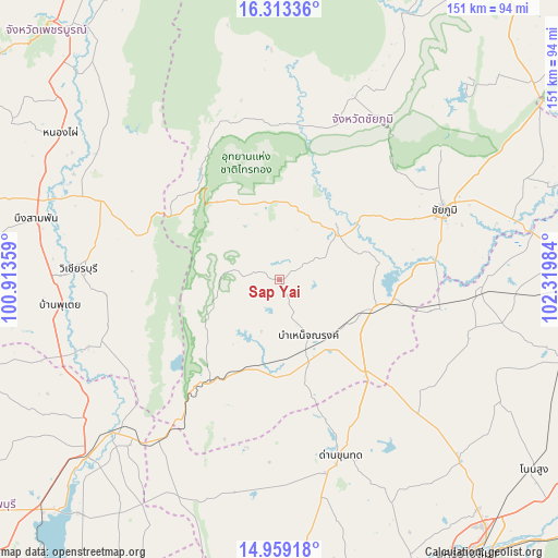
Sap Yai GPS coordinates[2]
15° 38' 14.604" North, 101° 37' 0.156" East
| Map corner | latitude | longitude |
|---|---|---|
| Upper-left | 16.31336°, | 100.91359° |
| Center: | 15.63739°, | 101.61671° |
| Lower-right: | 14.95918°, | 102.31984° |
| Map W x H: | 150.6×150.6 km | = 93.6×93.6mi |
| max Lat: | 20.43353° ⇑39.7% North |
| Sap Yai: | 15.63739° |
| min Lat: | ⇓60.3% South 5.77434° |
| min Long | Sap Yai | max Long |
| 97.93288° | 101.61671° | 105.49506° |
| W 62.2%⇐ | ⇒37.8% E |
Elevation
Elevation of Sap Yai is 344 m = 1129 ft, and this is 218.5 m = 717 ft above average elevation for this country.
| Max E: |
1011 m = 3317 ft | 6.7% |
| Sap Yai | 344 m 1129 ft | |
| Avg. | 125.5 m = 412 ft | |
Min E: |
1 m = 3 ft | 93.3% |
See also: Thailand elevation on elevation.city.
Geographical zone
Sap Yai is located in North Torrid zone (between Equator and Tropic of Cancer). Distance of this Northern Tropic circle is 867.2 km =538.9 mi to North.| Distance of | km | miles | from Sap Yai |
|---|---|---|---|
| North Pole | 8268.3 | 5137.7 | to North |
| Arctic Circle | 5662.5 | 3518.5 | to North |
| Tropic Cancer | 867.2 | 538.9 | to North |
| Equator | 1738.7 | 1080.4 | to South |


Nearby cities:
15 places around Sap Yai: (largest is in red/bold)
• Bamnet Narong
17 km =10.6 mi,  152°
152°
• Ban Khwao
34.8 km =21.6 mi,  63°
63°
• Ban Lueam
55 km =34.2 mi,  93°
93°
• Chaiyaphum
48.1 km =29.9 mi,  66°
66°
• Chatturat
25.8 km =16 mi,  108°
108°
• Dan Khun Thot
50.5 km =31.4 mi,  160°
160°
• Lam Sonthi
46.2 km =28.7 mi,  215°
215°
• Noen Sa-nga
42 km =26.1 mi,  101°
101°
• Nong Bua Daeng
53 km =32.9 mi,  21°
21°
• Nong Bua Rawe
20.3 km =12.6 mi,  50°
50°
• Phakdi Chumphon
36.3 km =22.6 mi,  325°
325°
• Phra Thong Kham
59.7 km =37.1 mi,  133°
133°
• Thep Sathit
32.5 km =20.2 mi,  213°
213°
• Thepharak
37.2 km =23.1 mi,  190°
190°
• Wichian Buri
54.7 km =34 mi,  272°
272°
Sources, notices
• [Note1] Compared only with cities in Thailand existing in our database
• [Src1] Map data: © OpenStreetMap contributors (CC-BY-SA)
• [Src2] Other city data from geonames.org with taken over terms of usage.
• [Src3] Geographical zone / Annual Mean Temperature by Robert A. Rohde @ Wikipedia
