Bueng Khong Long geodata
Bueng Khong Long (Changwat Bueng Kan) is a seat of a second-order administrative division; located in Thailand in Asia/Bangkok (GMT+7) time zone. In our database, there are 331 cities with bigger population. Compared to other cities in Thailand, 88.2% of cities are located further ↓South; 91% of cities are located further ←West and 74.3% of cities have lower elevation than Bueng Khong Long. Note1


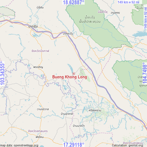
Bueng Khong Long GPS coordinates[2]
17° 57' 40.644" North, 104° 2' 48.012" East
| Map corner | latitude | longitude |
|---|---|---|
| Upper-left | 18.62887°, | 103.34355° |
| Center: | 17.96129°, | 104.04667° |
| Lower-right: | 17.29118°, | 104.7498° |
| Map W x H: | 148.7×148.7 km | = 92.4×92.4mi |
| max Lat: | 20.43353° ⇑11.8% North |
| Bueng Khong Long: | 17.96129° |
| min Lat: | ⇓88.2% South 5.77434° |
| min Long | Bueng Khong Lon | max Long |
| 97.93288° | 104.04667° | 105.49506° |
| W 91%⇐ | ⇒9% E |
Elevation
Elevation of Bueng Khong Long is 181 m = 594 ft, and this is 55.5 m = 182 ft above average elevation for this country.
| Max E: |
1011 m = 3317 ft | 25.7% |
| Bueng Khong Long | 181 m 594 ft | |
| Avg. | 125.5 m = 412 ft | |
Min E: |
1 m = 3 ft | 74.3% |
See also: Thailand elevation on elevation.city.
Geographical zone
Bueng Khong Long is located in North Torrid zone (between Equator and Tropic of Cancer). Distance of this Northern Tropic circle is 608.8 km =378.3 mi to North.| Distance of | km | miles | from Bueng Khong Long |
|---|---|---|---|
| North Pole | 8010 | 4977.2 | to North |
| Arctic Circle | 5404.1 | 3358 | to North |
| Tropic Cancer | 608.8 | 378.3 | to North |
| Equator | 1997.1 | 1240.9 | to South |


Nearby cities:
15 places around Bueng Khong Long: (largest is in red/bold)
• Akat Amnuai
41.2 km =25.6 mi,  189°
189°
• Ban Muang
52 km =32.3 mi,  256°
256°
• Ban Phaeng
17.8 km =11.1 mi,  88°
88°
• Bueng Kan
61.1 km =38 mi,  316°
316°
• Bung Khla
38.7 km =24 mi,  348°
348°
• Kham Ta Kla
33 km =20.5 mi,  248°
248°
• Na Thom
20.2 km =12.6 mi,  166°
166°
• Na Wa
52.7 km =32.7 mi, 173°
• Nathom
20.1 km =12.5 mi, 166°
• Phon Charoen
36.5 km =22.7 mi,  282°
282°
• Seka
10.3 km =6.4 mi, 249°
• Si Songkhram
42.9 km =26.7 mi,  149°
149°
• Si Wilai
40 km =24.9 mi,  307°
307°
• So Phisai
65.1 km =40.5 mi, 281°
• Wanon Niwat
47.9 km =29.8 mi,  220°
220°
Sources, notices
• [Note1] Compared only with cities in Thailand existing in our database
• [Src1] Map data: © OpenStreetMap contributors (CC-BY-SA)
• [Src2] Other city data from geonames.org with taken over terms of usage.
• [Src3] Geographical zone / Annual Mean Temperature by Robert A. Rohde @ Wikipedia
