Si Wilai geodata
Si Wilai (Changwat Bueng Kan) is a seat of a second-order administrative division; located in Thailand in Asia/Bangkok (GMT+7) time zone. In our database, there are 331 cities with bigger population. Compared to other cities in Thailand, 90.4% of cities are located further ↓South; 87.4% of cities are located further ←West and 72.1% of cities have lower elevation than Si Wilai. Note1


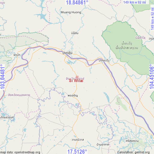
Si Wilai GPS coordinates[2]
18° 10' 54.768" North, 103° 44' 52.548" East
| Map corner | latitude | longitude |
|---|---|---|
| Upper-left | 18.84861°, | 103.04481° |
| Center: | 18.18188°, | 103.74793° |
| Lower-right: | 17.5126°, | 104.45106° |
| Map W x H: | 148.6×148.6 km | = 92.3×92.3mi |
| max Lat: | 20.43353° ⇑9.6% North |
| Si Wilai: | 18.18188° |
| min Lat: | ⇓90.4% South 5.77434° |
| min Long | Si Wilai | max Long |
| 97.93288° | 103.74793° | 105.49506° |
| W 87.4%⇐ | ⇒12.6% E |
Elevation
Elevation of Si Wilai is 175 m = 574 ft, and this is 49.5 m = 162 ft above average elevation for this country.
| Max E: |
1011 m = 3317 ft | 27.9% |
| Si Wilai | 175 m 574 ft | |
| Avg. | 125.5 m = 412 ft | |
Min E: |
1 m = 3 ft | 72.1% |
See also: Thailand elevation on elevation.city.
Geographical zone
Si Wilai is located in North Torrid zone (between Equator and Tropic of Cancer). Distance of this Northern Tropic circle is 584.3 km =363.1 mi to North.| Distance of | km | miles | from Si Wilai |
|---|---|---|---|
| North Pole | 7985.4 | 4961.9 | to North |
| Arctic Circle | 5379.5 | 3342.7 | to North |
| Tropic Cancer | 584.3 | 363.1 | to North |
| Equator | 2021.6 | 1256.2 | to South |


Nearby cities:
15 places around Si Wilai: (largest is in red/bold)
• Ban Muang
41.4 km =25.7 mi,  207°
207°
• Ban Phaeng
55 km =34.2 mi,  116°
116°
• Bueng Kan
22.5 km =14 mi,  333°
333°
• Bueng Khong Long
40 km =24.9 mi,  127°
127°
• Bung Khla
27.4 km =17 mi,  60°
60°
• Fao Rai
50.3 km =31.3 mi,  248°
248°
• Kham Ta Kla
36.7 km =22.8 mi,  178°
178°
• Na Thom
57.1 km =35.5 mi,  140°
140°
• Nathom
57.1 km =35.5 mi, 140°
• Pak Khat
48.8 km =30.3 mi,  286°
286°
• Pakkhat
48.3 km =30 mi, 285°
• Phon Charoen
17.2 km =10.7 mi,  193°
193°
• Rattanawapi
60.1 km =37.3 mi,  273°
273°
• Seka
35.7 km =22.2 mi, 142°
• So Phisai
34.2 km =21.3 mi, 250°
Sources, notices
• [Note1] Compared only with cities in Thailand existing in our database
• [Src1] Map data: © OpenStreetMap contributors (CC-BY-SA)
• [Src2] Other city data from geonames.org with taken over terms of usage.
• [Src3] Geographical zone / Annual Mean Temperature by Robert A. Rohde @ Wikipedia
