Na Mom geodata
Na Mom (Songkhla) is a seat of a second-order administrative division; located in Thailand in Asia/Bangkok (GMT+7) time zone. With population of 7,537 people, there are 298 cities with bigger population in this country. Compared to other cities in Thailand, 95% of cities are located further ↑North; 55.3% of cities are located further →East and 62.2% of cities have higher elevation than Na Mom. Note1


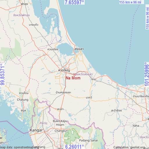
Na Mom GPS coordinates[2]
6° 57' 30.816" North, 100° 33' 24.588" East
| Map corner | latitude | longitude |
|---|---|---|
| Upper-left | 7.65597°, | 99.85371° |
| Center: | 6.95856°, | 100.55683° |
| Lower-right: | 6.26011°, | 101.25996° |
| Map W x H: | 155.2×155.2 km | = 96.4×96.4mi |
| max Lat: | 20.43353° ⇑95% North |
| Na Mom: | 6.95856° |
| min Lat: | ⇓5% South 5.77434° |
| min Long | Na Mom | max Long |
| 97.93288° | 100.55683° | 105.49506° |
| W 44.7%⇐ | ⇒55.3% E |
Elevation
Elevation of Na Mom is 38 m = 125 ft, and this is 87.5 m = 287 ft below average elevation for this country.
| Max E: |
1011 m = 3317 ft | 62.2% |
| Avg. | 125.5 m = 412 ft | |
| Na Mom | 38 m = 125 ft | |
Min E: |
1 m = 3 ft | 37.8% |
See also: Thailand elevation on elevation.city.
Geographical zone
Na Mom is located in North Torrid zone (between Equator and Tropic of Cancer). Distance of Equator is 773.7 km =480.8 mi to South.| Distance of | km | miles | from Na Mom |
|---|---|---|---|
| North Pole | 9233.3 | 5737.3 | to North |
| Arctic Circle | 6627.5 | 4118.1 | to North |
| Tropic Cancer | 1832.2 | 1138.5 | to North |
| Equator | 773.7 | 480.8 | to South |


Nearby cities:
15 places around Na Mom: (largest is in red/bold)
• Ban Mai
27.3 km =17 mi,  357°
357°
• Bang Klam
21.7 km =13.5 mi,  312°
312°
• Chana
20.8 km =12.9 mi,  103°
103°
• Hat Yai
10.4 km =6.5 mi,  302°
302°
• Khlong Hoi Khong
19.7 km =12.2 mi,  250°
250°
• Khuan Kalong
55 km =34.2 mi,  256°
256°
• Khuan Niang
34.3 km =21.3 mi,  319°
319°
• Na Thawi
28.3 km =17.6 mi,  148°
148°
• Pa Bon
54.9 km =34.1 mi, 309°
• Pak Phayun
50.2 km =31.2 mi,  328°
328°
• Rattaphum
38.5 km =23.9 mi, 300°
• Sadao
38.5 km =23.9 mi,  202°
202°
• Singhanakhon
31.2 km =19.4 mi, 359°
• Songkhla
27 km =16.8 mi,  8°
8°
• Thepha
47.2 km =29.3 mi,  107°
107°
Sources, notices
• [Note1] Compared only with cities in Thailand existing in our database
• [Src1] Map data: © OpenStreetMap contributors (CC-BY-SA)
• [Src2] Other city data from geonames.org with taken over terms of usage.
• [Src3] Geographical zone / Annual Mean Temperature by Robert A. Rohde @ Wikipedia
