Roghun geodata
Roghun (Republican Subordination) is a populated place; located in Tajikistan in Asia/Dushanbe (GMT+5) time zone. With population of 7,731 people, there are 42 cities with bigger population in this country. Compared to other cities in Tajikistan, 60.2% of cities are located further ↓South; 70.5% of cities are located further ←West and 69.3% of cities have lower elevation than Roghun. Note1


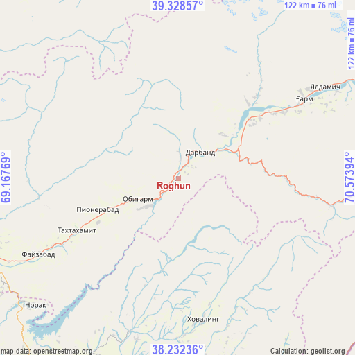
Roghun GPS coordinates[2]
38° 46' 57.252" North, 69° 52' 14.916" East
| Map corner | latitude | longitude |
|---|---|---|
| Upper-left | 39.32857°, | 69.16769° |
| Center: | 38.78257°, | 69.87081° |
| Lower-right: | 38.23236°, | 70.57394° |
| Map W x H: | 121.9×121.9 km | = 75.7×75.7mi |
| max Lat: | 40.99827° ⇑39.8% North |
| Roghun: | 38.78257° |
| min Lat: | ⇓60.2% South 36.72484° |
| min Long | Roghun | max Long |
| 67.60931° | 69.87081° | 73.96674° |
| W 70.5%⇐ | ⇒29.5% E |
Elevation
Elevation of Roghun is 1251 m = 4104 ft, and this is 288.5 m = 947 ft above average elevation for this country.
| Max E: |
3607 m = 11834 ft | 30.7% |
| Roghun | 1251 m 4104 ft | |
| Avg. | 962.5 m = 3158 ft | |
Min E: |
324 m = 1063 ft | 69.3% |
See also: Tajikistan elevation on elevation.city.
Geographical zone
Roghun is located in North temperate zone (between Tropic of Cancer and the Arctic Circle). Distance of this Northern Tropic circle is 1706.3 km =1060.2 mi to South.| Distance of | km | miles | from Roghun |
|---|---|---|---|
| North Pole | 5694.8 | 3538.6 | to North |
| Arctic Circle | 3089 | 1919.4 | to North |
| Tropic Cancer | 1706.3 | 1060.2 | to South |
| Equator | 4312.2 | 2679.5 | to South |


Nearby cities:
15 places around Roghun: (largest is in red/bold)
• Baljuvon
55.4 km =34.4 mi,  197°
197°
• Darband
12.6 km =7.8 mi,  41°
41°
• Fayzobod
54.5 km =33.9 mi,  241°
241°
• Khovaling
49.8 km =30.9 mi,  169°
169°
• Mehron
86.7 km =53.9 mi,  324°
324°
• Mŭ’minobod
76.4 km =47.5 mi, 169°
• Norak
64.7 km =40.2 mi,  227°
227°
• Novobod
35.1 km =21.8 mi, 43°
• Obigarm
15.8 km =9.8 mi, 242°
• Rasht
51.5 km =32 mi,  57°
57°
• Roghun
15.3 km =9.5 mi, 229°
• Sovet
85.4 km =53.1 mi, 196°
• Tagob
84.5 km =52.5 mi,  274°
274°
• Tavildara
54.1 km =33.6 mi,  100°
100°
• Vahdat
78.6 km =48.8 mi,  251°
251°
Sources, notices
• [Note1] Compared only with cities in Tajikistan existing in our database
• [Src1] Map data: © OpenStreetMap contributors (CC-BY-SA)
• [Src2] Other city data from geonames.org with taken over terms of usage.
• [Src3] Geographical zone / Annual Mean Temperature by Robert A. Rohde @ Wikipedia
