Roghun geodata
Roghun (Republican Subordination) is a seat of a second-order administrative division; located in Tajikistan in Asia/Dushanbe (GMT+5) time zone. In our database, there are 65 cities with bigger population. Compared to other cities in Tajikistan, 54.5% of cities are located further ↓South; 67% of cities are located further ←West and 81.8% of cities have lower elevation than Roghun. Note1


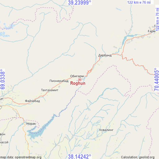
Roghun GPS coordinates[2]
38° 41' 35.916" North, 69° 44' 12.912" East
| Map corner | latitude | longitude |
|---|---|---|
| Upper-left | 39.23999°, | 69.0338° |
| Center: | 38.69331°, | 69.73692° |
| Lower-right: | 38.14242°, | 70.44005° |
| Map W x H: | 122×122 km | = 75.8×75.8mi |
| max Lat: | 40.99827° ⇑45.5% North |
| Roghun: | 38.69331° |
| min Lat: | ⇓54.5% South 36.72484° |
| min Long | Roghun | max Long |
| 67.60931° | 69.73692° | 73.96674° |
| W 67%⇐ | ⇒33% E |
Elevation
Elevation of Roghun is 1454 m = 4770 ft, and this is 491.5 m = 1613 ft above average elevation for this country.
| Max E: |
3607 m = 11834 ft | 18.2% |
| Roghun | 1454 m 4770 ft | |
| Avg. | 962.5 m = 3158 ft | |
Min E: |
324 m = 1063 ft | 81.8% |
See also: Tajikistan elevation on elevation.city.
Geographical zone
Roghun is located in North temperate zone (between Tropic of Cancer and the Arctic Circle). Distance of this Northern Tropic circle is 1696.4 km =1054.1 mi to South.| Distance of | km | miles | from Roghun |
|---|---|---|---|
| North Pole | 5704.8 | 3544.8 | to North |
| Arctic Circle | 3098.9 | 1925.6 | to North |
| Tropic Cancer | 1696.4 | 1054.1 | to South |
| Equator | 4302.3 | 2673.3 | to South |


Nearby cities:
15 places around Roghun: (largest is in red/bold)
• Baljuvon
43.1 km =26.8 mi,  186°
186°
• Darband
27.8 km =17.3 mi,  45°
45°
• Fayzobod
39.7 km =24.7 mi,  245°
245°
• Khovaling
44.2 km =27.5 mi,  152°
152°
• Mŭ’minobod
70.1 km =43.6 mi,  158°
158°
• Norak
49.4 km =30.7 mi,  226°
226°
• Novobod
50.3 km =31.3 mi, 45°
• Obigarm
3.6 km =2.2 mi,  317°
317°
• Rasht
66.6 km =41.4 mi,  55°
55°
• Roghun
15.3 km =9.5 mi, 49°
• Sovet
73.1 km =45.4 mi, 190°
• Tagob
74.5 km =46.3 mi,  282°
282°
• Tavildara
64.9 km =40.3 mi,  89°
89°
• Vahdat
64.7 km =40.2 mi,  256°
256°
• Yovon
74 km =46 mi,  235°
235°
Sources, notices
• [Note1] Compared only with cities in Tajikistan existing in our database
• [Src1] Map data: © OpenStreetMap contributors (CC-BY-SA)
• [Src2] Other city data from geonames.org with taken over terms of usage.
• [Src3] Geographical zone / Annual Mean Temperature by Robert A. Rohde @ Wikipedia
