Novobod geodata
Novobod (Republican Subordination) is a populated place; located in Tajikistan in Asia/Dushanbe (GMT+5) time zone. With population of 5,352 people, there are 47 cities with bigger population in this country. Compared to other cities in Tajikistan, 63.6% of cities are located further ↓South; 77.3% of cities are located further ←West and 73.9% of cities have lower elevation than Novobod. Note1


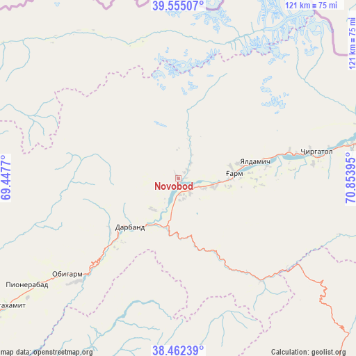
Novobod GPS coordinates[2]
39° 0' 39.024" North, 70° 9' 2.952" East
| Map corner | latitude | longitude |
|---|---|---|
| Upper-left | 39.55507°, | 69.4477° |
| Center: | 39.01084°, | 70.15082° |
| Lower-right: | 38.46239°, | 70.85395° |
| Map W x H: | 121.5×121.5 km | = 75.5×75.5mi |
| max Lat: | 40.99827° ⇑36.4% North |
| Novobod: | 39.01084° |
| min Lat: | ⇓63.6% South 36.72484° |
| min Long | Novobod | max Long |
| 67.60931° | 70.15082° | 73.96674° |
| W 77.3%⇐ | ⇒22.7% E |
Elevation
Elevation of Novobod is 1276 m = 4186 ft, and this is 313.5 m = 1029 ft above average elevation for this country.
| Max E: |
3607 m = 11834 ft | 26.1% |
| Novobod | 1276 m 4186 ft | |
| Avg. | 962.5 m = 3158 ft | |
Min E: |
324 m = 1063 ft | 73.9% |
See also: Tajikistan elevation on elevation.city.
Geographical zone
Novobod is located in North temperate zone (between Tropic of Cancer and the Arctic Circle). Distance of this Northern Tropic circle is 1731.7 km =1076 mi to South.| Distance of | km | miles | from Novobod |
|---|---|---|---|
| North Pole | 5669.5 | 3522.9 | to North |
| Arctic Circle | 3063.6 | 1903.6 | to North |
| Tropic Cancer | 1731.7 | 1076 | to South |
| Equator | 4337.6 | 2695.3 | to South |


Nearby cities:
15 places around Novobod: (largest is in red/bold)
• Baljuvon
88.3 km =54.9 mi,  207°
207°
• Darband
22.5 km =14 mi,  225°
225°
• Fayzobod
88.6 km =55.1 mi, 234°
• Jirghatol
92.7 km =57.6 mi,  75°
75°
• Khovaling
75.9 km =47.2 mi,  191°
191°
• Mehron
87.1 km =54.1 mi,  301°
301°
• Norak
99.7 km =62 mi, 226°
• Obigarm
50.3 km =31.3 mi, 229°
• Qalaikhumb
83.1 km =51.6 mi,  138°
138°
• Rasht
19.4 km =12.1 mi, 84°
• Roghun
35.1 km =21.8 mi,  223°
223°
• Roghun
50.3 km =31.3 mi, 225°
• Tajikobod
60.8 km =37.8 mi, 78°
• Tavildara
45.4 km =28.2 mi, 140°
• Vorukh
100.5 km =62.4 mi,  21°
21°
Sources, notices
• [Note1] Compared only with cities in Tajikistan existing in our database
• [Src1] Map data: © OpenStreetMap contributors (CC-BY-SA)
• [Src2] Other city data from geonames.org with taken over terms of usage.
• [Src3] Geographical zone / Annual Mean Temperature by Robert A. Rohde @ Wikipedia
