Darband geodata
Darband (Republican Subordination) is a seat of a second-order administrative division; located in Tajikistan in Asia/Dushanbe (GMT+5) time zone. With population of 1,115 people, there are 63 cities with bigger population in this country. Compared to other cities in Tajikistan, 62.5% of cities are located further ↓South; 71.6% of cities are located further ←West and 70.5% of cities have lower elevation than Darband. Note1


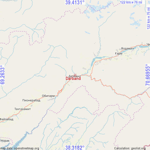
Darband GPS coordinates[2]
38° 52' 3.936" North, 69° 57' 59.112" East
| Map corner | latitude | longitude |
|---|---|---|
| Upper-left | 39.4131°, | 69.2633° |
| Center: | 38.86776°, | 69.96642° |
| Lower-right: | 38.3182°, | 70.66955° |
| Map W x H: | 121.7×121.7 km | = 75.6×75.6mi |
| max Lat: | 40.99827° ⇑37.5% North |
| Darband: | 38.86776° |
| min Lat: | ⇓62.5% South 36.72484° |
| min Long | Darband | max Long |
| 67.60931° | 69.96642° | 73.96674° |
| W 71.6%⇐ | ⇒28.4% E |
Elevation
Elevation of Darband is 1254 m = 4114 ft, and this is 291.5 m = 956 ft above average elevation for this country.
| Max E: |
3607 m = 11834 ft | 29.5% |
| Darband | 1254 m 4114 ft | |
| Avg. | 962.5 m = 3158 ft | |
Min E: |
324 m = 1063 ft | 70.5% |
See also: Tajikistan elevation on elevation.city.
Geographical zone
Darband is located in North temperate zone (between Tropic of Cancer and the Arctic Circle). Distance of this Northern Tropic circle is 1715.8 km =1066.1 mi to South.| Distance of | km | miles | from Darband |
|---|---|---|---|
| North Pole | 5685.4 | 3532.7 | to North |
| Arctic Circle | 3079.5 | 1913.5 | to North |
| Tropic Cancer | 1715.8 | 1066.1 | to South |
| Equator | 4321.7 | 2685.4 | to South |


Nearby cities:
15 places around Darband: (largest is in red/bold)
• Baljuvon
67.1 km =41.7 mi,  202°
202°
• Fayzobod
66.5 km =41.3 mi,  237°
237°
• Khovaling
58.5 km =36.4 mi,  179°
179°
• Mehron
84.6 km =52.6 mi,  316°
316°
• Mŭ’minobod
84.8 km =52.7 mi, 176°
• Norak
77.2 km =48 mi,  226°
226°
• Novobod
22.5 km =14 mi,  45°
45°
• Obigarm
27.9 km =17.3 mi, 233°
• Qalaikhumb
85 km =52.8 mi,  122°
122°
• Rasht
39.6 km =24.6 mi,  63°
63°
• Roghun
12.6 km =7.8 mi,  221°
221°
• Roghun
27.8 km =17.3 mi, 225°
• Tajikobod
80.7 km =50.1 mi,  69°
69°
• Tavildara
48.8 km =30.3 mi,  113°
113°
• Vahdat
89.6 km =55.7 mi,  247°
247°
Sources, notices
• [Note1] Compared only with cities in Tajikistan existing in our database
• [Src1] Map data: © OpenStreetMap contributors (CC-BY-SA)
• [Src2] Other city data from geonames.org with taken over terms of usage.
• [Src3] Geographical zone / Annual Mean Temperature by Robert A. Rohde @ Wikipedia
