Rasht geodata
Rasht (Republican Subordination) is a seat of a second-order administrative division; located in Tajikistan in Asia/Dushanbe (GMT+5) time zone. With population of 10,771 people, there are 33 cities with bigger population in this country. Compared to other cities in Tajikistan, 64.8% of cities are located further ↓South; 79.5% of cities are located further ←West and 76.1% of cities have lower elevation than Rasht. Note1


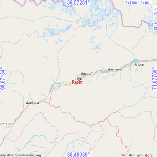
Rasht GPS coordinates[2]
39° 1' 43.356" North, 70° 22' 28.056" East
| Map corner | latitude | longitude |
|---|---|---|
| Upper-left | 39.57281°, | 69.67134° |
| Center: | 39.02871°, | 70.37446° |
| Lower-right: | 38.48039°, | 71.07759° |
| Map W x H: | 121.5×121.5 km | = 75.5×75.5mi |
| max Lat: | 40.99827° ⇑35.2% North |
| Rasht: | 39.02871° |
| min Lat: | ⇓64.8% South 36.72484° |
| min Long | Rasht | max Long |
| 67.60931° | 70.37446° | 73.96674° |
| W 79.5%⇐ | ⇒20.5% E |
Elevation
Elevation of Rasht is 1371 m = 4498 ft, and this is 408.5 m = 1340 ft above average elevation for this country.
| Max E: |
3607 m = 11834 ft | 23.9% |
| Rasht | 1371 m 4498 ft | |
| Avg. | 962.5 m = 3158 ft | |
Min E: |
324 m = 1063 ft | 76.1% |
See also: Tajikistan elevation on elevation.city.
Geographical zone
Rasht is located in North temperate zone (between Tropic of Cancer and the Arctic Circle). Distance of this Northern Tropic circle is 1733.7 km =1077.3 mi to South.| Distance of | km | miles | from Rasht |
|---|---|---|---|
| North Pole | 5667.5 | 3521.6 | to North |
| Arctic Circle | 3061.6 | 1902.4 | to North |
| Tropic Cancer | 1733.7 | 1077.3 | to South |
| Equator | 4339.6 | 2696.5 | to South |


Nearby cities:
15 places around Rasht: (largest is in red/bold)
• Baljuvon
100.4 km =62.4 mi,  217°
217°
• Darband
39.6 km =24.6 mi,  243°
243°
• Fayzobod
105.9 km =65.8 mi, 239°
• Jirghatol
73.6 km =45.7 mi,  73°
73°
• Karakenja
101.8 km =63.3 mi,  76°
76°
• Khovaling
83.9 km =52.1 mi,  204°
204°
• Mehron
103.2 km =64.1 mi,  294°
294°
• Novobod
19.4 km =12.1 mi,  264°
264°
• Obigarm
67.2 km =41.8 mi, 238°
• Qalaikhumb
73.3 km =45.5 mi,  150°
150°
• Roghun
51.5 km =32 mi, 237°
• Roghun
66.6 km =41.4 mi, 235°
• Tajikobod
41.6 km =25.8 mi, 75°
• Tavildara
38.3 km =23.8 mi,  165°
165°
• Vorukh
93.1 km =57.8 mi,  10°
10°
Sources, notices
• [Note1] Compared only with cities in Tajikistan existing in our database
• [Src1] Map data: © OpenStreetMap contributors (CC-BY-SA)
• [Src2] Other city data from geonames.org with taken over terms of usage.
• [Src3] Geographical zone / Annual Mean Temperature by Robert A. Rohde @ Wikipedia
