Jirghatol geodata
Jirghatol (Republican Subordination) is a seat of a second-order administrative division; located in Tajikistan in Asia/Dushanbe (GMT+5) time zone. In our database, there are 65 cities with bigger population. Compared to other cities in Tajikistan, 67% of cities are located further ↓South; 92% of cities are located further ←West and 90.9% of cities have lower elevation than Jirghatol. Note1


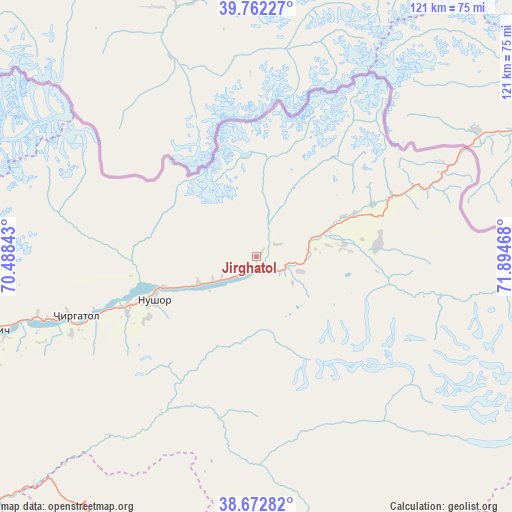
Jirghatol GPS coordinates[2]
39° 13' 10.776" North, 71° 11' 29.58" East
| Map corner | latitude | longitude |
|---|---|---|
| Upper-left | 39.76227°, | 70.48843° |
| Center: | 39.21966°, | 71.19155° |
| Lower-right: | 38.67282°, | 71.89468° |
| Map W x H: | 121.1×121.1 km | = 75.2×75.2mi |
| max Lat: | 40.99827° ⇑33% North |
| Jirghatol: | 39.21966° |
| min Lat: | ⇓67% South 36.72484° |
| min Long | Jirghatol | max Long |
| 67.60931° | 71.19155° | 73.96674° |
| W 92%⇐ | ⇒8% E |
Elevation
Elevation of Jirghatol is 1837 m = 6027 ft, and this is 874.5 m = 2869 ft above average elevation for this country.
| Max E: |
3607 m = 11834 ft | 9.1% |
| Jirghatol | 1837 m 6027 ft | |
| Avg. | 962.5 m = 3158 ft | |
Min E: |
324 m = 1063 ft | 90.9% |
See also: Tajikistan elevation on elevation.city.
Geographical zone
Jirghatol is located in North temperate zone (between Tropic of Cancer and the Arctic Circle). Distance of this Northern Tropic circle is 1754.9 km =1090.4 mi to South.| Distance of | km | miles | from Jirghatol |
|---|---|---|---|
| North Pole | 5646.2 | 3508.4 | to North |
| Arctic Circle | 3040.4 | 1889.2 | to North |
| Tropic Cancer | 1754.9 | 1090.4 | to South |
| Equator | 4360.8 | 2709.7 | to South |


Nearby cities:
15 places around Jirghatol: (largest is in red/bold)
• Darband
112.8 km =70.1 mi,  249°
249°
• Isfara
111.9 km =69.5 mi,  334°
334°
• Karakenja
28.7 km =17.8 mi,  86°
86°
• Kim
126.1 km =78.4 mi, 330°
• Konibodom
136 km =84.5 mi, 331°
• Neftobod
122.7 km =76.2 mi, 334°
• Novobod
92.7 km =57.6 mi,  255°
255°
• Qalaikhumb
92 km =57.2 mi,  202°
202°
• Rasht
73.6 km =45.7 mi, 253°
• Roghun
124 km =77.1 mi, 246°
• Shŭrob
107.4 km =66.7 mi, 328°
• Tajikobod
32.1 km =19.9 mi, 250°
• Tavildara
84.5 km =52.5 mi,  226°
226°
• Vanj
97.1 km =60.3 mi,  166°
166°
• Vorukh
87.6 km =54.4 mi,  323°
323°
Sources, notices
• [Note1] Compared only with cities in Tajikistan existing in our database
• [Src1] Map data: © OpenStreetMap contributors (CC-BY-SA)
• [Src2] Other city data from geonames.org with taken over terms of usage.
• [Src3] Geographical zone / Annual Mean Temperature by Robert A. Rohde @ Wikipedia
