Vorukh geodata
Vorukh (Sughd) is a populated place; located in Tajikistan in Asia/Dushanbe (GMT+5) time zone. With population of 3,836 people, there are 54 cities with bigger population in this country. Compared to other cities in Tajikistan, 73.9% of cities are located further ↓South; 87.5% of cities are located further ←West and 77.3% of cities have lower elevation than Vorukh. Note1


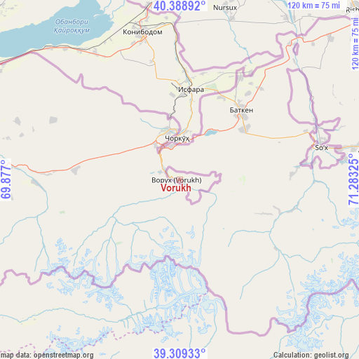
Vorukh GPS coordinates[2]
39° 51' 4.5" North, 70° 34' 48.432" East
| Map corner | latitude | longitude |
|---|---|---|
| Upper-left | 40.38892°, | 69.877° |
| Center: | 39.85125°, | 70.58012° |
| Lower-right: | 39.30933°, | 71.28325° |
| Map W x H: | 120×120 km | = 74.6×74.6mi |
| max Lat: | 40.99827° ⇑26.1% North |
| Vorukh: | 39.85125° |
| min Lat: | ⇓73.9% South 36.72484° |
| min Long | Vorukh | max Long |
| 67.60931° | 70.58012° | 73.96674° |
| W 87.5%⇐ | ⇒12.5% E |
Elevation
Elevation of Vorukh is 1400 m = 4593 ft, and this is 437.5 m = 1435 ft above average elevation for this country.
| Max E: |
3607 m = 11834 ft | 22.7% |
| Vorukh | 1400 m 4593 ft | |
| Avg. | 962.5 m = 3158 ft | |
Min E: |
324 m = 1063 ft | 77.3% |
See also: Tajikistan elevation on elevation.city.
Geographical zone
Vorukh is located in North temperate zone (between Tropic of Cancer and the Arctic Circle). Distance of this Northern Tropic circle is 1825.1 km =1134.1 mi to South.| Distance of | km | miles | from Vorukh |
|---|---|---|---|
| North Pole | 5576 | 3464.8 | to North |
| Arctic Circle | 2970.1 | 1845.5 | to North |
| Tropic Cancer | 1825.1 | 1134.1 | to South |
| Equator | 4431 | 2753.3 | to South |


Nearby cities:
15 places around Vorukh: (largest is in red/bold)
• Chkalov
86.6 km =53.8 mi,  299°
299°
• Ghafurov
83 km =51.6 mi, 299°
• Isfara
30.8 km =19.1 mi,  7°
7°
• Jirghatol
87.6 km =54.4 mi,  143°
143°
• Khŭjand
94.6 km =58.8 mi, 300°
• Kim
40.8 km =25.4 mi,  346°
346°
• Konibodom
50.8 km =31.6 mi, 345°
• Neftobod
40.5 km =25.2 mi,  359°
359°
• Novobod
100.5 km =62.4 mi,  201°
201°
• Palos
88.4 km =54.9 mi,  305°
305°
• Proletar
98.3 km =61.1 mi,  290°
290°
• Rasht
93.1 km =57.8 mi,  190°
190°
• Shaydon
93.1 km =57.8 mi, 347°
• Shŭrob
21.9 km =13.6 mi, 351°
• Tajikobod
83.9 km =52.1 mi,  164°
164°
Sources, notices
• [Note1] Compared only with cities in Tajikistan existing in our database
• [Src1] Map data: © OpenStreetMap contributors (CC-BY-SA)
• [Src2] Other city data from geonames.org with taken over terms of usage.
• [Src3] Geographical zone / Annual Mean Temperature by Robert A. Rohde @ Wikipedia
