Magtymguly geodata
Magtymguly (Balkan) is a seat of a second-order administrative division; located in Turkmenistan in Asia/Ashgabat (GMT+5) time zone. In our database, there are 30 cities with bigger population. Compared to other cities in Turkmenistan, 53.3% of cities are located further ↑North; 83.3% of cities are located further →East and 90% of cities have lower elevation than Magtymguly. Note1


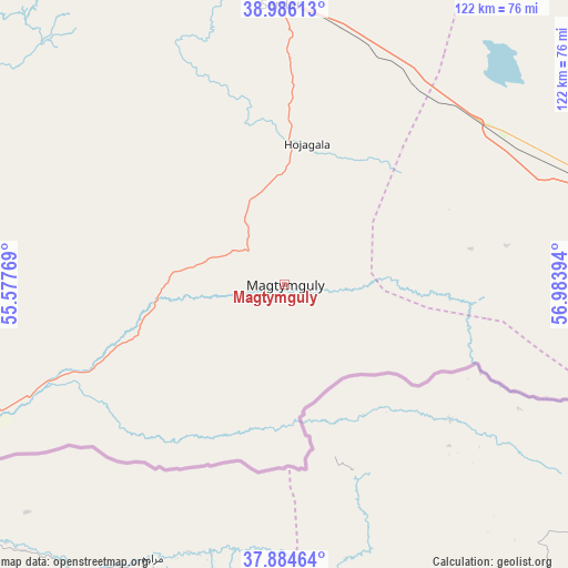
Magtymguly GPS coordinates[2]
38° 26' 14.964" North, 56° 16' 50.916" East
| Map corner | latitude | longitude |
|---|---|---|
| Upper-left | 38.98613°, | 55.57769° |
| Center: | 38.43749°, | 56.28081° |
| Lower-right: | 37.88464°, | 56.98394° |
| Map W x H: | 122.5×122.5 km | = 76.1×76.1mi |
| max Lat: | 42.32773° ⇑53.3% North |
| Magtymguly: | 38.43749° |
| min Lat: | ⇓46.7% South 35.27992° |
| min Long | Magtymguly | max Long |
| 52.95517° | 56.28081° | 66.04656° |
| W 16.7%⇐ | ⇒83.3% E |
Elevation
Elevation of Magtymguly is 314 m = 1030 ft, and this is 117.6 m = 386 ft above average elevation for this country.
| Max E: |
649 m = 2129 ft | 10% |
| Magtymguly | 314 m 1030 ft | |
| Avg. | 196.4 m = 644 ft | |
Min E: |
5 m = 16 ft | 90% |
See also: Turkmenistan elevation on elevation.city.
Geographical zone
Magtymguly is located in North temperate zone (between Tropic of Cancer and the Arctic Circle). Distance of this Northern Tropic circle is 1667.9 km =1036.4 mi to South.| Distance of | km | miles | from Magtymguly |
|---|---|---|---|
| North Pole | 5733.2 | 3562.4 | to North |
| Arctic Circle | 3127.3 | 1943.2 | to North |
| Tropic Cancer | 1667.9 | 1036.4 | to South |
| Equator | 4273.8 | 2655.6 | to South |


Nearby cities:
11 places around Magtymguly: (largest is in red/bold)
• Abadan
172.7 km =107.3 mi,  104°
104°
• Annau
204.7 km =127.2 mi,  107°
107°
• Arçabil
168.5 km =104.7 mi, 110°
• Ashgabat
191.6 km =119.1 mi, 106°
• Baharly
100.2 km =62.3 mi,  90°
90°
• Balkanabat
204 km =126.8 mi,  305°
305°
• Bereket
111.6 km =69.3 mi,  323°
323°
• Gumdag
169.5 km =105.3 mi,  300°
300°
• Kaka
316.6 km =196.7 mi, 112°
• Serdar
59.9 km =37.2 mi,  359°
359°
• Türkmenbaşy
336.3 km =209 mi, 301°
Sources, notices
• [Note1] Compared only with cities in Turkmenistan existing in our database
• [Src1] Map data: © OpenStreetMap contributors (CC-BY-SA)
• [Src2] Other city data from geonames.org with taken over terms of usage.
• [Src3] Geographical zone / Annual Mean Temperature by Robert A. Rohde @ Wikipedia
