Arçabil geodata
Arçabil (Ahal) is a populated place; located in Turkmenistan in Asia/Ashgabat (GMT+5) time zone. With population of 3,000 people, there are 29 cities with bigger population in this country. Compared to other cities in Turkmenistan, 66.7% of cities are located further ↑North; 76.7% of cities are located further →East and 100% of cities have lower elevation than Arçabil. Note1


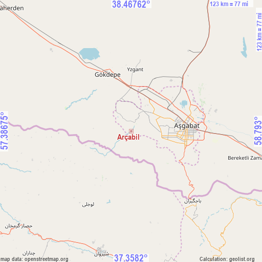
Arçabil GPS coordinates[2]
37° 54' 54" North, 58° 5' 23.532" East
| Map corner | latitude | longitude |
|---|---|---|
| Upper-left | 38.46762°, | 57.38675° |
| Center: | 37.915°, | 58.08987° |
| Lower-right: | 37.3582°, | 58.793° |
| Map W x H: | 123.4×123.4 km | = 76.7×76.7mi |
| max Lat: | 42.32773° ⇑66.7% North |
| Arçabil: | 37.915° |
| min Lat: | ⇓33.3% South 35.27992° |
| min Long | Arçabil | max Long |
| 52.95517° | 58.08987° | 66.04656° |
| W 23.3%⇐ | ⇒76.7% E |
Elevation
Elevation of Arçabil is 649 m = 2129 ft, and this is 452.6 m = 1485 ft above average elevation for this country.
| Max E: |
649 m = 2129 ft | 0% |
| Arçabil | 649 m 2129 ft | |
| Avg. | 196.4 m = 644 ft | |
Min E: |
5 m = 16 ft | 100% |
See also: Turkmenistan elevation on elevation.city.
Geographical zone
Arçabil is located in North temperate zone (between Tropic of Cancer and the Arctic Circle). Distance of this Northern Tropic circle is 1609.8 km =1000.3 mi to South.| Distance of | km | miles | from Arçabil |
|---|---|---|---|
| North Pole | 5791.3 | 3598.5 | to North |
| Arctic Circle | 3185.4 | 1979.3 | to North |
| Tropic Cancer | 1609.8 | 1000.3 | to South |
| Equator | 4215.8 | 2619.6 | to South |


Nearby cities:
12 places around Arçabil: (largest is in red/bold)
• Abadan
18.1 km =11.2 mi,  31°
31°
• Annau
37.5 km =23.3 mi,  94°
94°
• Ashgabat
26 km =16.2 mi,  81°
81°
• Baharly
81.7 km =50.8 mi,  315°
315°
• Bereket
268.2 km =166.7 mi,  303°
303°
• Gumdag
336.4 km =209 mi, 295°
• Kaka
148.3 km =92.1 mi,  115°
115°
• Magtymguly
168.5 km =104.7 mi,  290°
290°
• Mary
330.7 km =205.5 mi,  96°
96°
• Murgab
344.6 km =214.1 mi, 97°
• Serdar
197.2 km =122.5 mi,  306°
306°
• Tejen
220.7 km =137.1 mi,  105°
105°
Sources, notices
• [Note1] Compared only with cities in Turkmenistan existing in our database
• [Src1] Map data: © OpenStreetMap contributors (CC-BY-SA)
• [Src2] Other city data from geonames.org with taken over terms of usage.
• [Src3] Geographical zone / Annual Mean Temperature by Robert A. Rohde @ Wikipedia
