Annau geodata
Annau (Ahal) is a seat of a first-order administrative division; located in Turkmenistan in Asia/Ashgabat (GMT+5) time zone. With population of 27,526 people, there are 13 cities with bigger population in this country. Compared to other cities in Turkmenistan, 70% of cities are located further ↑North; 66.7% of cities are located further →East and 80% of cities have lower elevation than Annau. Note1


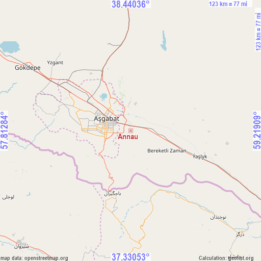
Annau GPS coordinates[2]
37° 53' 15.144" North, 58° 30' 57.456" East
| Map corner | latitude | longitude |
|---|---|---|
| Upper-left | 38.44036°, | 57.81284° |
| Center: | 37.88754°, | 58.51596° |
| Lower-right: | 37.33053°, | 59.21909° |
| Map W x H: | 123.4×123.4 km | = 76.7×76.7mi |
| max Lat: | 42.32773° ⇑70% North |
| Annau: | 37.88754° |
| min Lat: | ⇓30% South 35.27992° |
| min Long | Annau | max Long |
| 52.95517° | 58.51596° | 66.04656° |
| W 33.3%⇐ | ⇒66.7% E |
Elevation
Elevation of Annau is 247 m = 810 ft, and this is 50.6 m = 166 ft above average elevation for this country.
| Max E: |
649 m = 2129 ft | 20% |
| Annau | 247 m 810 ft | |
| Avg. | 196.4 m = 644 ft | |
Min E: |
5 m = 16 ft | 80% |
See also: Turkmenistan elevation on elevation.city.
Geographical zone
Annau is located in North temperate zone (between Tropic of Cancer and the Arctic Circle). Distance of this Northern Tropic circle is 1606.8 km =998.4 mi to South.| Distance of | km | miles | from Annau |
|---|---|---|---|
| North Pole | 5794.4 | 3600.5 | to North |
| Arctic Circle | 3188.5 | 1981.2 | to North |
| Tropic Cancer | 1606.8 | 998.4 | to South |
| Equator | 4212.7 | 2617.6 | to South |


Nearby cities:
13 places around Annau: (largest is in red/bold)
• Abadan
33.5 km =20.8 mi,  303°
303°
• Arçabil
37.5 km =23.3 mi,  274°
274°
• Ashgabat
13.5 km =8.4 mi, 300°
• Baharly
112.7 km =70 mi, 302°
• Bayramaly
322.4 km =200.3 mi,  95°
95°
• Bereket
301.3 km =187.2 mi, 300°
• Kaka
113.8 km =70.7 mi,  121°
121°
• Magtymguly
204.7 km =127.2 mi,  287°
287°
• Mary
293.2 km =182.2 mi, 96°
• Murgab
307.1 km =190.8 mi, 98°
• Serdar
229.6 km =142.7 mi, 301°
• Tejen
183.9 km =114.3 mi,  107°
107°
• Yolöten
344.9 km =214.3 mi, 100°
Sources, notices
• [Note1] Compared only with cities in Turkmenistan existing in our database
• [Src1] Map data: © OpenStreetMap contributors (CC-BY-SA)
• [Src2] Other city data from geonames.org with taken over terms of usage.
• [Src3] Geographical zone / Annual Mean Temperature by Robert A. Rohde @ Wikipedia
