Gazojak geodata
Gazojak (Lebap) is a populated place; located in Turkmenistan in Asia/Ashgabat (GMT+5) time zone. With population of 21,021 people, there are 19 cities with bigger population in this country. Compared to other cities in Turkmenistan, 80% of cities are located further ↓South; 63.3% of cities are located further ←West and 63.3% of cities have higher elevation than Gazojak. Note1


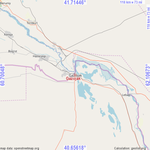
Gazojak GPS coordinates[2]
41° 11' 14.856" North, 61° 24' 12.96" East
| Map corner | latitude | longitude |
|---|---|---|
| Upper-left | 41.71446°, | 60.70048° |
| Center: | 41.18746°, | 61.4036° |
| Lower-right: | 40.65618°, | 62.10673° |
| Map W x H: | 117.7×117.7 km | = 73.1×73.1mi |
| max Lat: | 42.32773° ⇑20% North |
| Gazojak: | 41.18746° |
| min Lat: | ⇓80% South 35.27992° |
| min Long | Gazojak | max Long |
| 52.95517° | 61.4036° | 66.04656° |
| W 63.3%⇐ | ⇒36.7% E |
Elevation
Elevation of Gazojak is 123 m = 404 ft, and this is 73.4 m = 241 ft below average elevation for this country.
| Max E: |
649 m = 2129 ft | 63.3% |
| Avg. | 196.4 m = 644 ft | |
| Gazojak | 123 m = 404 ft | |
Min E: |
5 m = 16 ft | 36.7% |
See also: Turkmenistan elevation on elevation.city.
Geographical zone
Gazojak is located in North temperate zone (between Tropic of Cancer and the Arctic Circle). Distance of this Northern Tropic circle is 1973.7 km =1226.4 mi to South.| Distance of | km | miles | from Gazojak |
|---|---|---|---|
| North Pole | 5427.4 | 3372.4 | to North |
| Arctic Circle | 2821.6 | 1753.3 | to North |
| Tropic Cancer | 1973.7 | 1226.4 | to South |
| Equator | 4579.6 | 2845.6 | to South |


Nearby cities:
14 places around Gazojak: (largest is in red/bold)
• Akdepe
194 km =120.5 mi,  299°
299°
• Bayramaly
402.2 km =249.9 mi,  170°
170°
• Boldumsaz
177.9 km =110.5 mi,  306°
306°
• Daşoguz
139.7 km =86.8 mi, 301°
• Farap
292.4 km =181.7 mi,  140°
140°
• Köneürgench
225.5 km =140.1 mi, 304°
• Mary
401.3 km =249.4 mi, 174°
• Murgab
413.3 km =256.8 mi, 173°
• Saýat
340.5 km =211.6 mi, 141°
• Seydi
228.8 km =142.2 mi,  145°
145°
• Tagta
134.3 km =83.5 mi,  292°
292°
• Tejen
430 km =267.2 mi,  190°
190°
• Türkmenabat
299.1 km =185.9 mi, 141°
• Yylanly
162.7 km =101.1 mi, 296°
Sources, notices
• [Note1] Compared only with cities in Turkmenistan existing in our database
• [Src1] Map data: © OpenStreetMap contributors (CC-BY-SA)
• [Src2] Other city data from geonames.org with taken over terms of usage.
• [Src3] Geographical zone / Annual Mean Temperature by Robert A. Rohde @ Wikipedia
