Saýat geodata
Saýat (Lebap) is a populated place; located in Turkmenistan in Asia/Ashgabat (GMT+5) time zone. With population of 17,762 people, there are 21 cities with bigger population in this country. Compared to other cities in Turkmenistan, 50% of cities are located further ↓South; 93.3% of cities are located further ←West and 56.7% of cities have lower elevation than Saýat. Note1


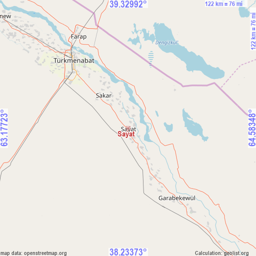
Saýat GPS coordinates[2]
38° 47' 2.148" North, 63° 52' 49.26" East
| Map corner | latitude | longitude |
|---|---|---|
| Upper-left | 39.32992°, | 63.17723° |
| Center: | 38.78393°, | 63.88035° |
| Lower-right: | 38.23373°, | 64.58348° |
| Map W x H: | 121.9×121.9 km | = 75.7×75.7mi |
| max Lat: | 42.32773° ⇑50% North |
| Saýat: | 38.78393° |
| min Lat: | ⇓50% South 35.27992° |
| min Long | Saýat | max Long |
| 52.95517° | 63.88035° | 66.04656° |
| W 93.3%⇐ | ⇒6.7% E |
Elevation
Elevation of Saýat is 203 m = 666 ft, and this is 6.6 m = 22 ft above average elevation for this country.
| Max E: |
649 m = 2129 ft | 43.3% |
| Saýat | 203 m 666 ft | |
| Avg. | 196.4 m = 644 ft | |
Min E: |
5 m = 16 ft | 56.7% |
See also: Turkmenistan elevation on elevation.city.
Geographical zone
Saýat is located in North temperate zone (between Tropic of Cancer and the Arctic Circle). Distance of this Northern Tropic circle is 1706.4 km =1060.3 mi to South.| Distance of | km | miles | from Saýat |
|---|---|---|---|
| North Pole | 5694.7 | 3538.5 | to North |
| Arctic Circle | 3088.8 | 1919.3 | to North |
| Tropic Cancer | 1706.4 | 1060.3 | to South |
| Equator | 4312.4 | 2679.6 | to South |


Nearby cities:
12 places around Saýat: (largest is in red/bold)
• Atamyrat
156.8 km =97.4 mi,  132°
132°
• Bayramaly
198 km =123 mi,  229°
229°
• Farap
48.8 km =30.3 mi,  331°
331°
• Gazojak
340.5 km =211.6 mi,  321°
321°
• Gowurdak
217.7 km =135.3 mi,  119°
119°
• Mary
222.7 km =138.4 mi, 233°
• Murgab
219.9 km =136.6 mi, 229°
• Serhetabat
412.8 km =256.5 mi,  199°
199°
• Seydi
113.9 km =70.8 mi,  312°
312°
• Tejen
333.9 km =207.5 mi,  242°
242°
• Türkmenabat
41.4 km =25.7 mi, 320°
• Yolöten
212.1 km =131.8 mi,  218°
218°
Sources, notices
• [Note1] Compared only with cities in Turkmenistan existing in our database
• [Src1] Map data: © OpenStreetMap contributors (CC-BY-SA)
• [Src2] Other city data from geonames.org with taken over terms of usage.
• [Src3] Geographical zone / Annual Mean Temperature by Robert A. Rohde @ Wikipedia
