Sejenane geodata
Sejenane (Banzart) is a populated place; located in Tunisia in Africa/Tunis (GMT+1) time zone. With population of 5,009 people, there are 120 cities with bigger population in this country. Compared to other cities in Tunisia, 93% of cities are located further ↓South; 78.3% of cities are located further →East and 69.9% of cities have lower elevation than Sejenane. Note1


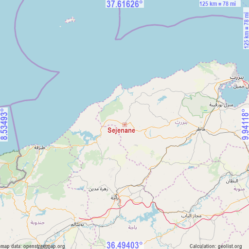
Sejenane GPS coordinates[2]
37° 3' 25.992" North, 9° 14' 17.016" East
| Map corner | latitude | longitude |
|---|---|---|
| Upper-left | 37.61626°, | 8.53493° |
| Center: | 37.05722°, | 9.23806° |
| Lower-right: | 36.49403°, | 9.94118° |
| Map W x H: | 124.8×124.8 km | = 77.5×77.5mi |
| max Lat: | 37.27442° ⇑7% North |
| Sejenane: | 37.05722° |
| min Lat: | ⇓93% South 32.31662° |
| min Long | Sejenane | max Long |
| 7.87765° | 9.23806° | 11.21965° |
| W 21.7%⇐ | ⇒78.3% E |
Elevation
Elevation of Sejenane is 133 m = 436 ft, and this is 16.4 m = 54 ft below average elevation for this country.
| Max E: |
999 m = 3278 ft | 30.1% |
| Avg. | 149.4 m = 490 ft | |
| Sejenane | 133 m = 436 ft | |
Min E: |
-6 m = -20 ft | 69.9% |
See also: Tunisia elevation on elevation.city.
Geographical zone
Sejenane is located in North temperate zone (between Tropic of Cancer and the Arctic Circle). Distance of this Northern Tropic circle is 1514.5 km =941.1 mi to South.| Distance of | km | miles | from Sejenane |
|---|---|---|---|
| North Pole | 5886.7 | 3657.8 | to North |
| Arctic Circle | 3280.8 | 2038.6 | to North |
| Tropic Cancer | 1514.5 | 941.1 | to South |
| Equator | 4120.4 | 2560.3 | to South |


Nearby cities:
15 places around Sejenane: (largest is in red/bold)
• Bizerte
61.3 km =38.1 mi,  66°
66°
• Béja
37.2 km =23.1 mi,  187°
187°
• Douar Tindja
47 km =29.2 mi, 74°
• El Battan
60.8 km =37.8 mi,  117°
117°
• Fernana
65.7 km =40.8 mi,  227°
227°
• Goubellat
68.7 km =42.7 mi,  146°
146°
• Mateur
38 km =23.6 mi,  92°
92°
• Medjez el Bab
56.2 km =34.9 mi,  143°
143°
• Menzel Abderhaman
58.9 km =36.6 mi, 70°
• Menzel Bourguiba
49.8 km =30.9 mi,  77°
77°
• Menzel Jemil
63.2 km =39.3 mi, 71°
• Tabarka
44.1 km =27.4 mi,  254°
254°
• Tabursuq
66.8 km =41.5 mi,  179°
179°
• Testour
59.1 km =36.7 mi,  162°
162°
• Zahānah
71.1 km =44.2 mi, 91°
Sources, notices
• [Note1] Compared only with cities in Tunisia existing in our database
• [Src1] Map data: © OpenStreetMap contributors (CC-BY-SA)
• [Src2] Other city data from geonames.org with taken over terms of usage.
• [Src3] Geographical zone / Annual Mean Temperature by Robert A. Rohde @ Wikipedia
