Bou Attouche geodata
Bou Attouche (Qābis) is a populated place; located in Tunisia in Africa/Tunis (GMT+1) time zone. With population of 2,700 people, there are 138 cities with bigger population in this country. Compared to other cities in Tunisia, 88.1% of cities are located further ↑North; 67.8% of cities are located further →East and 54.5% of cities have lower elevation than Bou Attouche. Note1


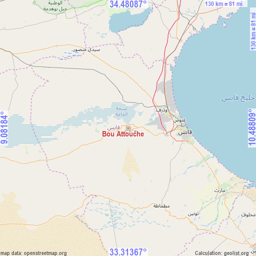
Bou Attouche GPS coordinates[2]
33° 53' 57.372" North, 9° 47' 5.856" East
| Map corner | latitude | longitude |
|---|---|---|
| Upper-left | 34.48087°, | 9.08184° |
| Center: | 33.89927°, | 9.78496° |
| Lower-right: | 33.31367°, | 10.48809° |
| Map W x H: | 129.8×129.8 km | = 80.7×80.7mi |
| max Lat: | 37.27442° ⇑88.1% North |
| Bou Attouche: | 33.89927° |
| min Lat: | ⇓11.9% South 32.31662° |
| min Long | Bou Attouche | max Long |
| 7.87765° | 9.78496° | 11.21965° |
| W 32.2%⇐ | ⇒67.8% E |
Elevation
Elevation of Bou Attouche is 55 m = 180 ft, and this is 94.4 m = 310 ft below average elevation for this country.
| Max E: |
999 m = 3278 ft | 45.5% |
| Avg. | 149.4 m = 490 ft | |
| Bou Attouche | 55 m = 180 ft | |
Min E: |
-6 m = -20 ft | 54.5% |
See also: Tunisia elevation on elevation.city.
Geographical zone
Bou Attouche is located in North temperate zone (between Tropic of Cancer and the Arctic Circle). Distance of this Northern Tropic circle is 1163.3 km =722.8 mi to South.| Distance of | km | miles | from Bou Attouche |
|---|---|---|---|
| North Pole | 6237.8 | 3876 | to North |
| Arctic Circle | 3631.9 | 2256.8 | to North |
| Tropic Cancer | 1163.3 | 722.8 | to South |
| Equator | 3769.2 | 2342.1 | to South |


Nearby cities:
15 places around Bou Attouche: (largest is in red/bold)
• As Sanad
78.9 km =49 mi,  322°
322°
• Beni Kheddache
81.5 km =50.6 mi,  151°
151°
• Bir Ali Ben Khalifa
97.2 km =60.4 mi,  16°
16°
• Douz
85.6 km =53.2 mi,  235°
235°
• El Golaa
85.5 km =53.1 mi, 237°
• El Hamma
1.4 km =0.9 mi,  129°
129°
• Erriadh
99.1 km =61.6 mi,  95°
95°
• Gabès
29 km =18 mi,  93°
93°
• Houmt El Souk
99 km =61.5 mi, 91°
• Jemna
79.7 km =49.5 mi, 243°
• Kebili
78.4 km =48.7 mi,  253°
253°
• Matmata
43.1 km =26.8 mi,  156°
156°
• Medenine
90.1 km =56 mi, 132°
• Mezzouna
75.6 km =47 mi,  3°
3°
• Skhira
51.6 km =32.1 mi,  30°
30°
Sources, notices
• [Note1] Compared only with cities in Tunisia existing in our database
• [Src1] Map data: © OpenStreetMap contributors (CC-BY-SA)
• [Src2] Other city data from geonames.org with taken over terms of usage.
• [Src3] Geographical zone / Annual Mean Temperature by Robert A. Rohde @ Wikipedia
