Beni Kheddache geodata
Beni Kheddache (Madanīn) is a populated place; located in Tunisia in Africa/Tunis (GMT+1) time zone. With population of 3,588 people, there are 129 cities with bigger population in this country. Compared to other cities in Tunisia, 97.9% of cities are located further ↑North; 51.7% of cities are located further ←West and 90.9% of cities have lower elevation than Beni Kheddache. Note1


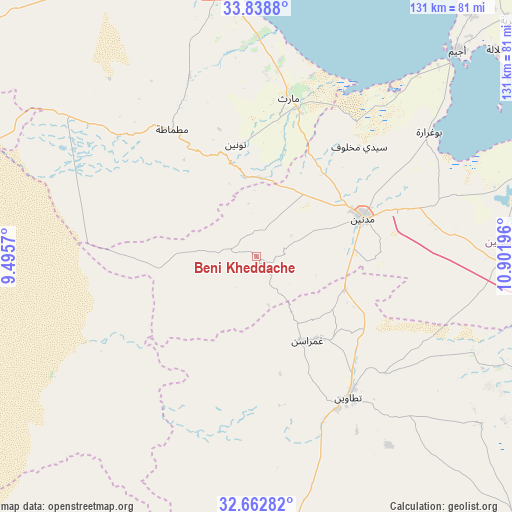
Beni Kheddache GPS coordinates[2]
33° 15' 10.044" North, 10° 11' 55.788" East
| Map corner | latitude | longitude |
|---|---|---|
| Upper-left | 33.8388°, | 9.4957° |
| Center: | 33.25279°, | 10.19883° |
| Lower-right: | 32.66282°, | 10.90196° |
| Map W x H: | 130.8×130.8 km | = 81.3×81.3mi |
| max Lat: | 37.27442° ⇑97.9% North |
| Beni Kheddache: | 33.25279° |
| min Lat: | ⇓2.1% South 32.31662° |
| min Long | Beni Kheddache | max Long |
| 7.87765° | 10.19883° | 11.21965° |
| W 51.7%⇐ | ⇒48.3% E |
Elevation
Elevation of Beni Kheddache is 518 m = 1699 ft, and this is 368.6 m = 1209 ft above average elevation for this country.
| Max E: |
999 m = 3278 ft | 9.1% |
| Beni Kheddache | 518 m 1699 ft | |
| Avg. | 149.4 m = 490 ft | |
Min E: |
-6 m = -20 ft | 90.9% |
See also: Tunisia elevation on elevation.city.
Geographical zone
Beni Kheddache is located in North temperate zone (between Tropic of Cancer and the Arctic Circle). Distance of this Northern Tropic circle is 1091.4 km =678.2 mi to South.| Distance of | km | miles | from Beni Kheddache |
|---|---|---|---|
| North Pole | 6309.7 | 3920.7 | to North |
| Arctic Circle | 3703.8 | 2301.4 | to North |
| Tropic Cancer | 1091.4 | 678.2 | to South |
| Equator | 3697.4 | 2297.5 | to South |


Nearby cities:
15 places around Beni Kheddache: (largest is in red/bold)
• Ben Gardane
95.8 km =59.5 mi,  97°
97°
• Bou Attouche
81.5 km =50.6 mi,  331°
331°
• Douz
112 km =69.6 mi,  282°
282°
• El Golaa
113.7 km =70.6 mi, 283°
• El Hamma
80.2 km =49.8 mi, 332°
• Erriadh
87.6 km =54.4 mi,  43°
43°
• Gabès
70.5 km =43.8 mi,  352°
352°
• Houmt El Souk
92.3 km =57.4 mi, 41°
• Jemna
115.7 km =71.9 mi,  288°
288°
• Matmata
38.7 km =24 mi, 326°
• Medenine
30.7 km =19.1 mi,  68°
68°
• Midoun
96 km =59.7 mi,  49°
49°
• Remada
105.7 km =65.7 mi,  169°
169°
• Tataouine
43 km =26.7 mi,  146°
146°
• Zarzis
89.3 km =55.5 mi, 71°
Sources, notices
• [Note1] Compared only with cities in Tunisia existing in our database
• [Src1] Map data: © OpenStreetMap contributors (CC-BY-SA)
• [Src2] Other city data from geonames.org with taken over terms of usage.
• [Src3] Geographical zone / Annual Mean Temperature by Robert A. Rohde @ Wikipedia
