Şahinbey geodata
Şahinbey (Gaziantep) is a seat of a second-order administrative division; located in Turkey in Europe/Istanbul (GMT+3) time zone. In our database, there are 1323 cities with bigger population. Compared to other cities in Turkey, 87.1% of cities are located further ↑North; 58% of cities are located further ←West and 60.1% of cities have lower elevation than Şahinbey. Note1


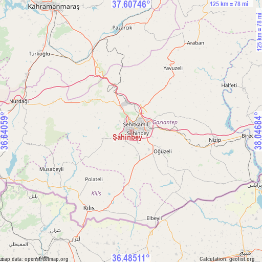
Şahinbey GPS coordinates[2]
37° 2' 54.096" North, 37° 20' 37.356" East
| Map corner | latitude | longitude |
|---|---|---|
| Upper-left | 37.60746°, | 36.64059° |
| Center: | 37.04836°, | 37.34371° |
| Lower-right: | 36.48511°, | 38.04684° |
| Map W x H: | 124.8×124.8 km | = 77.5×77.5mi |
| max Lat: | 42.02683° ⇑87.1% North |
| Şahinbey: | 37.04836° |
| min Lat: | ⇓12.9% South 35.9025° |
| min Long | Şahinbey | max Long |
| 25.90902° | 37.34371° | 44.60099° |
| W 58%⇐ | ⇒42% E |
Elevation
Elevation of Şahinbey is 883 m = 2897 ft, and this is 165.6 m = 543 ft above average elevation for this country.
| Max E: |
2682 m = 8799 ft | 39.9% |
| Şahinbey | 883 m 2897 ft | |
| Avg. | 717.4 m = 2354 ft | |
Min E: |
0 m = 0 ft | 60.1% |
See also: Turkey elevation on elevation.city.
Geographical zone
Şahinbey is located in North temperate zone (between Tropic of Cancer and the Arctic Circle). Distance of this Northern Tropic circle is 1513.5 km =940.4 mi to South.| Distance of | km | miles | from Şahinbey |
|---|---|---|---|
| North Pole | 5887.7 | 3658.4 | to North |
| Arctic Circle | 3281.8 | 2039.2 | to North |
| Tropic Cancer | 1513.5 | 940.4 | to South |
| Equator | 4119.4 | 2559.7 | to South |


Nearby cities:
15 places around Şahinbey: (largest is in red/bold)
• Burç
15.1 km =9.4 mi,  255°
255°
• Büyükkaracaören
36.3 km =22.6 mi,  150°
150°
• Doğanpınar
33.4 km =20.8 mi,  133°
133°
• Gaziantep
3.7 km =2.3 mi,  70°
70°
• Güldüzü
28.5 km =17.7 mi,  225°
225°
• Gündoğan
26.3 km =16.3 mi,  136°
136°
• Oğuzeli
17.6 km =10.9 mi,  121°
121°
• Polateli
29.1 km =18.1 mi,  217°
217°
• Sekili
30.1 km =18.7 mi,  104°
104°
• Uluyatır
32.5 km =20.2 mi,  106°
106°
• Yakacık
24.5 km =15.2 mi, 133°
• Yavuzeli
36 km =22.4 mi,  33°
33°
• Yeşildere
15.8 km =9.8 mi, 121°
• Zeytinli
12.8 km =8 mi, 147°
• Şehitkamil
4.7 km =2.9 mi,  42°
42°
Sources, notices
• [Note1] Compared only with cities in Turkey existing in our database
• [Src1] Map data: © OpenStreetMap contributors (CC-BY-SA)
• [Src2] Other city data from geonames.org with taken over terms of usage.
• [Src3] Geographical zone / Annual Mean Temperature by Robert A. Rohde @ Wikipedia
