Yavuzeli geodata
Yavuzeli (Gaziantep) is a seat of a second-order administrative division; located in Turkey in Europe/Istanbul (GMT+3) time zone. With population of 8,170 people, there are 569 cities with bigger population in this country. Compared to other cities in Turkey, 79.7% of cities are located further ↑North; 59.2% of cities are located further ←West and 56.3% of cities have higher elevation than Yavuzeli. Note1


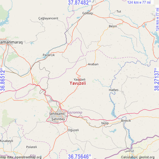
Yavuzeli GPS coordinates[2]
37° 19' 3.792" North, 37° 34' 5.664" East
| Map corner | latitude | longitude |
|---|---|---|
| Upper-left | 37.87482°, | 36.86512° |
| Center: | 37.31772°, | 37.56824° |
| Lower-right: | 36.75646°, | 38.27137° |
| Map W x H: | 124.3×124.4 km | = 77.2×77.3mi |
| max Lat: | 42.02683° ⇑79.7% North |
| Yavuzeli: | 37.31772° |
| min Lat: | ⇓20.3% South 35.9025° |
| min Long | Yavuzeli | max Long |
| 25.90902° | 37.56824° | 44.60099° |
| W 59.2%⇐ | ⇒40.8% E |
Elevation
Elevation of Yavuzeli is 565 m = 1854 ft, and this is 152.4 m = 500 ft below average elevation for this country.
| Max E: |
2682 m = 8799 ft | 56.3% |
| Avg. | 717.4 m = 2354 ft | |
| Yavuzeli | 565 m = 1854 ft | |
Min E: |
0 m = 0 ft | 43.7% |
See also: Turkey elevation on elevation.city.
Geographical zone
Yavuzeli is located in North temperate zone (between Tropic of Cancer and the Arctic Circle). Distance of this Northern Tropic circle is 1543.4 km =959 mi to South.| Distance of | km | miles | from Yavuzeli |
|---|---|---|---|
| North Pole | 5857.7 | 3639.8 | to North |
| Arctic Circle | 3251.8 | 2020.6 | to North |
| Tropic Cancer | 1543.4 | 959 | to South |
| Equator | 4149.3 | 2578.3 | to South |


Nearby cities:
15 places around Yavuzeli: (largest is in red/bold)
• Araban
16.1 km =10 mi,  41°
41°
• Belören
35.5 km =22.1 mi,  1°
1°
• Gaziantep
33.1 km =20.6 mi,  209°
209°
• Halfeti
27.8 km =17.3 mi,  106°
106°
• Keysun
37.1 km =23.1 mi, 43°
• Narlı
39.1 km =24.3 mi,  282°
282°
• Nizip
39.7 km =24.7 mi,  149°
149°
• Oğuzeli
39.4 km =24.5 mi,  187°
187°
• Pazarcık
30.3 km =18.8 mi,  308°
308°
• Sekili
38.8 km =24.1 mi,  166°
166°
• Suvarlı
25.2 km =15.7 mi,  12°
12°
• Uluyatır
40.9 km =25.4 mi,  164°
164°
• Yeşildere
38.9 km =24.2 mi, 189°
• Şahinbey
36 km =22.4 mi, 213°
• Şehitkamil
31.3 km =19.4 mi, 212°
Sources, notices
• [Note1] Compared only with cities in Turkey existing in our database
• [Src1] Map data: © OpenStreetMap contributors (CC-BY-SA)
• [Src2] Other city data from geonames.org with taken over terms of usage.
• [Src3] Geographical zone / Annual Mean Temperature by Robert A. Rohde @ Wikipedia
