Nurdağı geodata
Nurdağı (Gaziantep) is a seat of a second-order administrative division; located in Turkey in Europe/Istanbul (GMT+3) time zone. With population of 12,827 people, there are 433 cities with bigger population in this country. Compared to other cities in Turkey, 84.4% of cities are located further ↑North; 55.9% of cities are located further ←West and 61.5% of cities have higher elevation than Nurdağı. Note1


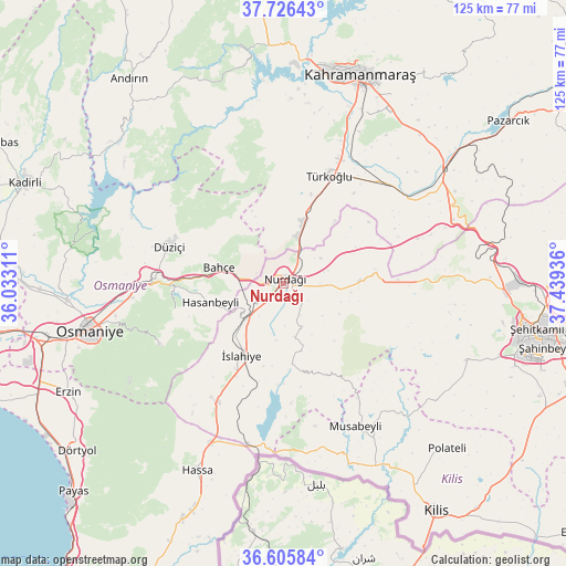
Nurdağı GPS coordinates[2]
37° 10' 5.556" North, 36° 44' 10.428" East
| Map corner | latitude | longitude |
|---|---|---|
| Upper-left | 37.72643°, | 36.03311° |
| Center: | 37.16821°, | 36.73623° |
| Lower-right: | 36.60584°, | 37.43936° |
| Map W x H: | 124.6×124.6 km | = 77.4×77.4mi |
| max Lat: | 42.02683° ⇑84.4% North |
| Nurdağı: | 37.16821° |
| min Lat: | ⇓15.6% South 35.9025° |
| min Long | Nurdağı | max Long |
| 25.90902° | 36.73623° | 44.60099° |
| W 55.9%⇐ | ⇒44.1% E |
Elevation
Elevation of Nurdağı is 486 m = 1594 ft, and this is 231.4 m = 759 ft below average elevation for this country.
| Max E: |
2682 m = 8799 ft | 61.5% |
| Avg. | 717.4 m = 2354 ft | |
| Nurdağı | 486 m = 1594 ft | |
Min E: |
0 m = 0 ft | 38.5% |
See also: Turkey elevation on elevation.city.
Geographical zone
Nurdağı is located in North temperate zone (between Tropic of Cancer and the Arctic Circle). Distance of this Northern Tropic circle is 1526.8 km =948.7 mi to South.| Distance of | km | miles | from Nurdağı |
|---|---|---|---|
| North Pole | 5874.3 | 3650.1 | to North |
| Arctic Circle | 3268.5 | 2031 | to North |
| Tropic Cancer | 1526.8 | 948.7 | to South |
| Equator | 4132.7 | 2567.9 | to South |


Nearby cities:
15 places around Nurdağı: (largest is in red/bold)
• Bahçe
14.5 km =9 mi,  282°
282°
• Burç
42.9 km =26.7 mi,  113°
113°
• Fevzipaşa
12 km =7.5 mi,  226°
226°
• Haruniye
26.2 km =16.3 mi,  288°
288°
• Hasanbeyli
17.4 km =10.8 mi,  255°
255°
• Hassa
45.4 km =28.2 mi,  205°
205°
• Kaypak
24.8 km =15.4 mi, 256°
• Musabeyli
35.3 km =21.9 mi,  152°
152°
• Narlı
43.2 km =26.8 mi,  54°
54°
• Osmaniye
44.5 km =27.7 mi, 256°
• Sakçagöz
16 km =9.9 mi,  88°
88°
• Türkoğlu
26 km =16.2 mi,  21°
21°
• Yarpuz
30.2 km =18.8 mi,  243°
243°
• Yedigöz
35 km =21.7 mi,  164°
164°
• İslahiye
18.5 km =11.5 mi, 210°
Sources, notices
• [Note1] Compared only with cities in Turkey existing in our database
• [Src1] Map data: © OpenStreetMap contributors (CC-BY-SA)
• [Src2] Other city data from geonames.org with taken over terms of usage.
• [Src3] Geographical zone / Annual Mean Temperature by Robert A. Rohde @ Wikipedia
