Sülüklü geodata
Sülüklü (Konya) is a seat of a third-order administrative division; located in Turkey in Europe/Istanbul (GMT+3) time zone. In our database, there are 1323 cities with bigger population. Compared to other cities in Turkey, 53% of cities are located further ↓South; 65.1% of cities are located further →East and 70.2% of cities have lower elevation than Sülüklü. Note1


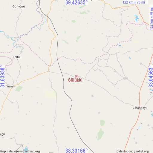
Sülüklü GPS coordinates[2]
38° 52' 51.996" North, 32° 20' 33" East
| Map corner | latitude | longitude |
|---|---|---|
| Upper-left | 39.42635°, | 31.63938° |
| Center: | 38.88111°, | 32.3425° |
| Lower-right: | 38.33166°, | 33.04563° |
| Map W x H: | 121.7×121.7 km | = 75.6×75.6mi |
| max Lat: | 42.02683° ⇑47% North |
| Sülüklü: | 38.88111° |
| min Lat: | ⇓53% South 35.9025° |
| min Long | Sülüklü | max Long |
| 25.90902° | 32.3425° | 44.60099° |
| W 34.9%⇐ | ⇒65.1% E |
Elevation
Elevation of Sülüklü is 1031 m = 3383 ft, and this is 313.6 m = 1029 ft above average elevation for this country.
| Max E: |
2682 m = 8799 ft | 29.8% |
| Sülüklü | 1031 m 3383 ft | |
| Avg. | 717.4 m = 2354 ft | |
Min E: |
0 m = 0 ft | 70.2% |
See also: Turkey elevation on elevation.city.
Geographical zone
Sülüklü is located in North temperate zone (between Tropic of Cancer and the Arctic Circle). Distance of this Northern Tropic circle is 1717.3 km =1067.1 mi to South.| Distance of | km | miles | from Sülüklü |
|---|---|---|---|
| North Pole | 5683.9 | 3531.8 | to North |
| Arctic Circle | 3078 | 1912.6 | to North |
| Tropic Cancer | 1717.3 | 1067.1 | to South |
| Equator | 4323.2 | 2686.3 | to South |


Nearby cities:
15 places around Sülüklü: (largest is in red/bold)
• Altpınar
50.2 km =31.2 mi,  44°
44°
• Cihanbeyli
56.1 km =34.9 mi,  115°
115°
• Günyüzü
72.3 km =44.9 mi,  320°
320°
• Haymana
62.7 km =39 mi,  12°
12°
• Kadınhanı
72.2 km =44.9 mi,  189°
189°
• Kulu
68 km =42.3 mi,  69°
69°
• Kurthasanlı
63.4 km =39.4 mi, 193°
• Kuyulusebil
30 km =18.6 mi,  147°
147°
• Sarayönü
69 km =42.9 mi,  175°
175°
• Turgut
54.1 km =33.6 mi,  238°
238°
• Yenice
52.6 km =32.7 mi,  33°
33°
• Yeniceoba
38.6 km =24 mi,  91°
91°
• Yenimehmetli
61.8 km =38.4 mi,  345°
345°
• Yunak
53.4 km =33.2 mi,  261°
261°
• Çeltik
50.3 km =31.3 mi,  288°
288°
Sources, notices
• [Note1] Compared only with cities in Turkey existing in our database
• [Src1] Map data: © OpenStreetMap contributors (CC-BY-SA)
• [Src2] Other city data from geonames.org with taken over terms of usage.
• [Src3] Geographical zone / Annual Mean Temperature by Robert A. Rohde @ Wikipedia
