Özpınar geodata
Özpınar (Siirt) is a seat of a third-order administrative division; located in Turkey in Europe/Istanbul (GMT+3) time zone. In our database, there are 1323 cities with bigger population. Compared to other cities in Turkey, 61.4% of cities are located further ↑North; 92.2% of cities are located further ←West and 93% of cities have lower elevation than Özpınar. Note1


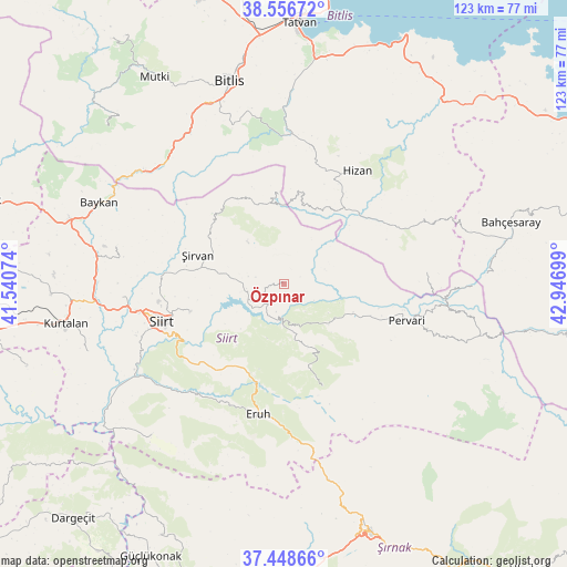
Özpınar GPS coordinates[2]
38° 0' 17.208" North, 42° 14' 37.896" East
| Map corner | latitude | longitude |
|---|---|---|
| Upper-left | 38.55672°, | 41.54074° |
| Center: | 38.00478°, | 42.24386° |
| Lower-right: | 37.44866°, | 42.94699° |
| Map W x H: | 123.2×123.2 km | = 76.6×76.6mi |
| max Lat: | 42.02683° ⇑61.4% North |
| Özpınar: | 38.00478° |
| min Lat: | ⇓38.6% South 35.9025° |
| min Long | Özpınar | max Long |
| 25.90902° | 42.24386° | 44.60099° |
| W 92.2%⇐ | ⇒7.8% E |
Elevation
Elevation of Özpınar is 1580 m = 5184 ft, and this is 862.6 m = 2830 ft above average elevation for this country.
| Max E: |
2682 m = 8799 ft | 7% |
| Özpınar | 1580 m 5184 ft | |
| Avg. | 717.4 m = 2354 ft | |
Min E: |
0 m = 0 ft | 93% |
See also: Turkey elevation on elevation.city.
Geographical zone
Özpınar is located in North temperate zone (between Tropic of Cancer and the Arctic Circle). Distance of this Northern Tropic circle is 1619.8 km =1006.5 mi to South.| Distance of | km | miles | from Özpınar |
|---|---|---|---|
| North Pole | 5781.3 | 3592.3 | to North |
| Arctic Circle | 3175.4 | 1973.1 | to North |
| Tropic Cancer | 1619.8 | 1006.5 | to South |
| Equator | 4225.7 | 2625.7 | to South |


Nearby cities:
15 places around Özpınar: (largest is in red/bold)
• Ayvalıbağ
21.3 km =13.2 mi,  104°
104°
• Cevizlik
19.1 km =11.9 mi,  355°
355°
• Durankaya
5.9 km =3.7 mi,  249°
249°
• Ekmekçiler
16.7 km =10.4 mi,  217°
217°
• Gökçekoru
18.8 km =11.7 mi,  106°
106°
• Karasungur
15.9 km =9.9 mi,  147°
147°
• Meydandere
15.6 km =9.7 mi,  235°
235°
• Ormandalı
22.3 km =13.9 mi, 108°
• Palamutlu
12.6 km =7.8 mi,  196°
196°
• Taşdibek
7.5 km =4.7 mi,  143°
143°
• Taşlı
9.7 km =6 mi,  258°
258°
• Tillo
21.2 km =13.2 mi, 253°
• Yeniaydın
21.7 km =13.5 mi,  129°
129°
• İkizbağlar
23.9 km =14.9 mi, 263°
• Şirvan
20.2 km =12.6 mi,  288°
288°
Sources, notices
• [Note1] Compared only with cities in Turkey existing in our database
• [Src1] Map data: © OpenStreetMap contributors (CC-BY-SA)
• [Src2] Other city data from geonames.org with taken over terms of usage.
• [Src3] Geographical zone / Annual Mean Temperature by Robert A. Rohde @ Wikipedia
