Durankaya geodata
Durankaya (Siirt) is a populated place; located in Turkey in Europe/Istanbul (GMT+3) time zone. With population of 515 people, there are 1303 cities with bigger population in this country. Compared to other cities in Turkey, 61.8% of cities are located further ↑North; 92% of cities are located further ←West and 83.1% of cities have lower elevation than Durankaya. Note1


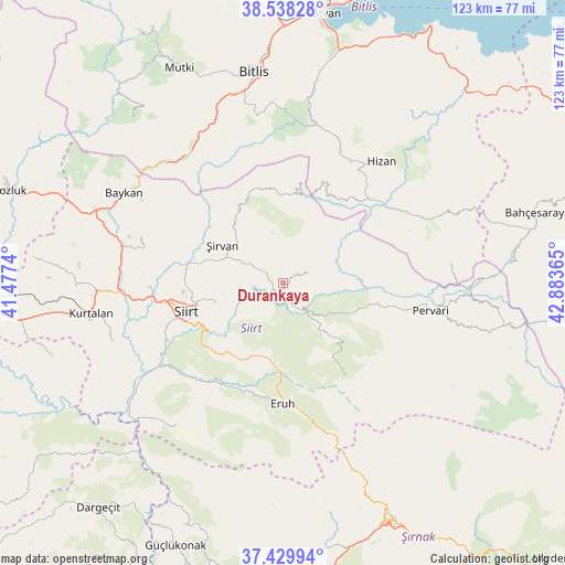
Durankaya GPS coordinates[2]
37° 59' 10.32" North, 42° 10' 49.872" East
| Map corner | latitude | longitude |
|---|---|---|
| Upper-left | 38.53828°, | 41.4774° |
| Center: | 37.9862°, | 42.18052° |
| Lower-right: | 37.42994°, | 42.88365° |
| Map W x H: | 123.2×123.2 km | = 76.6×76.6mi |
| max Lat: | 42.02683° ⇑61.8% North |
| Durankaya: | 37.9862° |
| min Lat: | ⇓38.2% South 35.9025° |
| min Long | Durankaya | max Long |
| 25.90902° | 42.18052° | 44.60099° |
| W 92%⇐ | ⇒8% E |
Elevation
Elevation of Durankaya is 1266 m = 4154 ft, and this is 548.6 m = 1800 ft above average elevation for this country.
| Max E: |
2682 m = 8799 ft | 16.9% |
| Durankaya | 1266 m 4154 ft | |
| Avg. | 717.4 m = 2354 ft | |
Min E: |
0 m = 0 ft | 83.1% |
See also: Turkey elevation on elevation.city.
Geographical zone
Durankaya is located in North temperate zone (between Tropic of Cancer and the Arctic Circle). Distance of this Northern Tropic circle is 1617.8 km =1005.3 mi to South.| Distance of | km | miles | from Durankaya |
|---|---|---|---|
| North Pole | 5783.4 | 3593.6 | to North |
| Arctic Circle | 3177.5 | 1974.4 | to North |
| Tropic Cancer | 1617.8 | 1005.3 | to South |
| Equator | 4223.7 | 2624.5 | to South |


Nearby cities:
15 places around Durankaya: (largest is in red/bold)
• Cevizlik
21.4 km =13.3 mi,  10°
10°
• Doluharman
23.2 km =14.4 mi,  269°
269°
• Doğanca
24.6 km =15.3 mi,  147°
147°
• Ekmekçiler
12.1 km =7.5 mi,  202°
202°
• Gökçekoru
23.8 km =14.8 mi,  98°
98°
• Karasungur
18 km =11.2 mi,  129°
129°
• Meydandere
10 km =6.2 mi,  227°
227°
• Palamutlu
10.2 km =6.3 mi,  169°
169°
• Siirt
21.9 km =13.6 mi,  253°
253°
• Taşdibek
10.8 km =6.7 mi,  111°
111°
• Taşlı
4 km =2.5 mi, 271°
• Tillo
15.3 km =9.5 mi, 254°
• Özpınar
5.9 km =3.7 mi,  69°
69°
• İkizbağlar
18.2 km =11.3 mi, 267°
• Şirvan
16 km =9.9 mi,  301°
301°
Sources, notices
• [Note1] Compared only with cities in Turkey existing in our database
• [Src1] Map data: © OpenStreetMap contributors (CC-BY-SA)
• [Src2] Other city data from geonames.org with taken over terms of usage.
• [Src3] Geographical zone / Annual Mean Temperature by Robert A. Rohde @ Wikipedia
