Nevşehir geodata
Nevşehir is a seat of a first-order administrative division; located in Turkey in Europe/Istanbul (GMT+3) time zone. With population of 75,527 people, there are 120 cities with bigger population in this country. Compared to other cities in Turkey, 51.2% of cities are located further ↑North; 55.7% of cities are located further →East and 80.9% of cities have lower elevation than Nevşehir. Note1


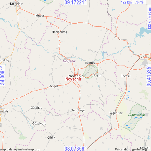
Nevşehir GPS coordinates[2]
38° 37' 30" North, 34° 42' 43.992" East
| Map corner | latitude | longitude |
|---|---|---|
| Upper-left | 39.17221°, | 34.0091° |
| Center: | 38.625°, | 34.71222° |
| Lower-right: | 38.07358°, | 35.41535° |
| Map W x H: | 122.2×122.2 km | = 75.9×75.9mi |
| max Lat: | 42.02683° ⇑51.2% North |
| Nevşehir: | 38.625° |
| min Lat: | ⇓48.8% South 35.9025° |
| min Long | Nevşehir | max Long |
| 25.90902° | 34.71222° | 44.60099° |
| W 44.3%⇐ | ⇒55.7% E |
Elevation
Elevation of Nevşehir is 1213 m = 3980 ft, and this is 495.6 m = 1626 ft above average elevation for this country.
| Max E: |
2682 m = 8799 ft | 19.1% |
| Nevşehir | 1213 m 3980 ft | |
| Avg. | 717.4 m = 2354 ft | |
Min E: |
0 m = 0 ft | 80.9% |
See also: Nevşehir elevation on elevation.city.
Geographical zone
Nevşehir is located in North temperate zone (between Tropic of Cancer and the Arctic Circle). Distance of this Northern Tropic circle is 1688.8 km =1049.4 mi to South.| Distance of | km | miles | from Nevşehir |
|---|---|---|---|
| North Pole | 5712.4 | 3549.5 | to North |
| Arctic Circle | 3106.5 | 1930.3 | to North |
| Tropic Cancer | 1688.8 | 1049.4 | to South |
| Equator | 4294.7 | 2668.6 | to South |


Nearby cities:
15 places around Nevşehir: (largest is in red/bold)
• Acıgöl
19.5 km =12.1 mi,  244°
244°
• Avanos
15.4 km =9.6 mi,  49°
49°
• Derinkuyu
27.9 km =17.3 mi,  176°
176°
• Göreme
10.9 km =6.8 mi,  78°
78°
• Gülağaç
40.8 km =25.4 mi,  231°
231°
• Gülşehir
15.4 km =9.6 mi,  330°
330°
• Hacıbektaş
37.6 km =23.4 mi,  339°
339°
• Himmetdede
46 km =28.6 mi, 46°
• Misli
44.1 km =27.4 mi,  172°
172°
• Salanda
27.2 km =16.9 mi,  324°
324°
• Topaklı
43.5 km =27 mi,  13°
13°
• Yeşilhisar
44.6 km =27.7 mi,  132°
132°
• Özonak
23.6 km =14.7 mi,  28°
28°
• Ürgüp
17.4 km =10.8 mi,  88°
88°
• İncesu
40.9 km =25.4 mi, 90°
Sources, notices
• [Note1] Compared only with cities in Turkey existing in our database
• [Src1] Map data: © OpenStreetMap contributors (CC-BY-SA)
• [Src2] Other city data from geonames.org with taken over terms of usage.
• [Src3] Geographical zone / Annual Mean Temperature by Robert A. Rohde @ Wikipedia
