Ürgüp geodata
Ürgüp (Nevşehir) is a seat of a second-order administrative division; located in Turkey in Europe/Istanbul (GMT+3) time zone. With population of 16,642 people, there are 371 cities with bigger population in this country. Compared to other cities in Turkey, 51.1% of cities are located further ↑North; 54.6% of cities are located further →East and 72.7% of cities have lower elevation than Ürgüp. Note1


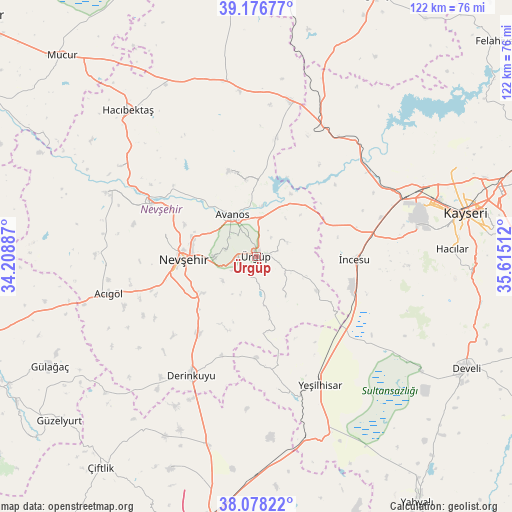
Ürgüp GPS coordinates[2]
38° 37' 46.56" North, 34° 54' 43.164" East
| Map corner | latitude | longitude |
|---|---|---|
| Upper-left | 39.17677°, | 34.20887° |
| Center: | 38.6296°, | 34.91199° |
| Lower-right: | 38.07822°, | 35.61512° |
| Map W x H: | 122.1×122.1 km | = 75.9×75.9mi |
| max Lat: | 42.02683° ⇑51.1% North |
| Ürgüp: | 38.6296° |
| min Lat: | ⇓48.9% South 35.9025° |
| min Long | Ürgüp | max Long |
| 25.90902° | 34.91199° | 44.60099° |
| W 45.4%⇐ | ⇒54.6% E |
Elevation
Elevation of Ürgüp is 1067 m = 3501 ft, and this is 349.6 m = 1147 ft above average elevation for this country.
| Max E: |
2682 m = 8799 ft | 27.3% |
| Ürgüp | 1067 m 3501 ft | |
| Avg. | 717.4 m = 2354 ft | |
Min E: |
0 m = 0 ft | 72.7% |
See also: Turkey elevation on elevation.city.
Geographical zone
Ürgüp is located in North temperate zone (between Tropic of Cancer and the Arctic Circle). Distance of this Northern Tropic circle is 1689.3 km =1049.7 mi to South.| Distance of | km | miles | from Ürgüp |
|---|---|---|---|
| North Pole | 5711.9 | 3549.2 | to North |
| Arctic Circle | 3106 | 1930 | to North |
| Tropic Cancer | 1689.3 | 1049.7 | to South |
| Equator | 4295.2 | 2668.9 | to South |


Nearby cities:
15 places around Ürgüp: (largest is in red/bold)
• Acıgöl
36.1 km =22.4 mi,  255°
255°
• Avanos
11.1 km =6.9 mi,  329°
329°
• Derinkuyu
32.3 km =20.1 mi,  208°
208°
• Göreme
6.8 km =4.2 mi,  283°
283°
• Gülşehir
28 km =17.4 mi,  297°
297°
• Hacıbektaş
46.3 km =28.8 mi,  318°
318°
• Hacılar
46.7 km =29 mi,  87°
87°
• Himmetdede
35.1 km =21.8 mi,  27°
27°
• Misli
45.8 km =28.5 mi,  194°
194°
• Nevşehir
17.4 km =10.8 mi,  268°
268°
• Salanda
39.5 km =24.5 mi, 303°
• Topaklı
42.5 km =26.4 mi,  349°
349°
• Yeşilhisar
34.5 km =21.4 mi,  153°
153°
• Özonak
21.2 km =13.2 mi,  343°
343°
• İncesu
23.5 km =14.6 mi, 91°
Sources, notices
• [Note1] Compared only with cities in Turkey existing in our database
• [Src1] Map data: © OpenStreetMap contributors (CC-BY-SA)
• [Src2] Other city data from geonames.org with taken over terms of usage.
• [Src3] Geographical zone / Annual Mean Temperature by Robert A. Rohde @ Wikipedia
