Mursal geodata
Mursal (Sivas) is a seat of a third-order administrative division; located in Turkey in Europe/Istanbul (GMT+3) time zone. In our database, there are 1323 cities with bigger population. Compared to other cities in Turkey, 56.9% of cities are located further ↓South; 61.4% of cities are located further ←West and 98% of cities have lower elevation than Mursal. Note1


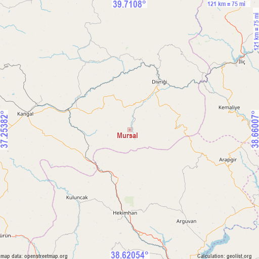
Mursal GPS coordinates[2]
39° 10' 4.008" North, 37° 57' 24.984" East
| Map corner | latitude | longitude |
|---|---|---|
| Upper-left | 39.7108°, | 37.25382° |
| Center: | 39.16778°, | 37.95694° |
| Lower-right: | 38.62054°, | 38.66007° |
| Map W x H: | 121.2×121.2 km | = 75.3×75.3mi |
| max Lat: | 42.02683° ⇑43.1% North |
| Mursal: | 39.16778° |
| min Lat: | ⇓56.9% South 35.9025° |
| min Long | Mursal | max Long |
| 25.90902° | 37.95694° | 44.60099° |
| W 61.4%⇐ | ⇒38.6% E |
Elevation
Elevation of Mursal is 1865 m = 6119 ft, and this is 1147.6 m = 3765 ft above average elevation for this country.
| Max E: |
2682 m = 8799 ft | 2% |
| Mursal | 1865 m 6119 ft | |
| Avg. | 717.4 m = 2354 ft | |
Min E: |
0 m = 0 ft | 98% |
See also: Turkey elevation on elevation.city.
Geographical zone
Mursal is located in North temperate zone (between Tropic of Cancer and the Arctic Circle). Distance of this Northern Tropic circle is 1749.1 km =1086.8 mi to South.| Distance of | km | miles | from Mursal |
|---|---|---|---|
| North Pole | 5652 | 3512 | to North |
| Arctic Circle | 3046.1 | 1892.8 | to North |
| Tropic Cancer | 1749.1 | 1086.8 | to South |
| Equator | 4355 | 2706.1 | to South |


Nearby cities:
15 places around Mursal: (largest is in red/bold)
• Alacahan
33.6 km =20.9 mi,  258°
258°
• Arapgir
48.5 km =30.1 mi,  106°
106°
• Beypınarı
43.4 km =27 mi,  330°
330°
• Danişment
20.8 km =12.9 mi,  88°
88°
• Divriği
26.3 km =16.3 mi,  30°
30°
• Gedikbaşı
43.6 km =27.1 mi, 34°
• Hasançelebi
25 km =15.5 mi,  195°
195°
• Hekimhan
39.2 km =24.4 mi,  183°
183°
• Kale
15.4 km =9.6 mi,  166°
166°
• Kavak
43.2 km =26.8 mi,  288°
288°
• Kemaliye
47.7 km =29.6 mi,  77°
77°
• Kuluncak
41.2 km =25.6 mi,  218°
218°
• Sincan
34.6 km =21.5 mi,  347°
347°
• Yoncalı
31.1 km =19.3 mi,  124°
124°
• Çetinkaya
30.4 km =18.9 mi, 290°
Sources, notices
• [Note1] Compared only with cities in Turkey existing in our database
• [Src1] Map data: © OpenStreetMap contributors (CC-BY-SA)
• [Src2] Other city data from geonames.org with taken over terms of usage.
• [Src3] Geographical zone / Annual Mean Temperature by Robert A. Rohde @ Wikipedia
