Hekimhan geodata
Hekimhan (Malatya) is a seat of a second-order administrative division; located in Turkey in Europe/Istanbul (GMT+3) time zone. With population of 13,946 people, there are 408 cities with bigger population in this country. Compared to other cities in Turkey, 52.2% of cities are located further ↓South; 61.3% of cities are located further ←West and 75.2% of cities have lower elevation than Hekimhan. Note1


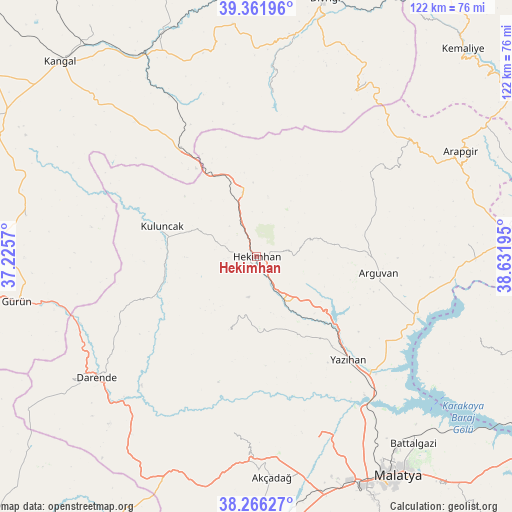
Hekimhan GPS coordinates[2]
38° 48' 58.392" North, 37° 55' 43.752" East
| Map corner | latitude | longitude |
|---|---|---|
| Upper-left | 39.36196°, | 37.2257° |
| Center: | 38.81622°, | 37.92882° |
| Lower-right: | 38.26627°, | 38.63195° |
| Map W x H: | 121.8×121.8 km | = 75.7×75.7mi |
| max Lat: | 42.02683° ⇑47.8% North |
| Hekimhan: | 38.81622° |
| min Lat: | ⇓52.2% South 35.9025° |
| min Long | Hekimhan | max Long |
| 25.90902° | 37.92882° | 44.60099° |
| W 61.3%⇐ | ⇒38.7% E |
Elevation
Elevation of Hekimhan is 1107 m = 3632 ft, and this is 389.6 m = 1278 ft above average elevation for this country.
| Max E: |
2682 m = 8799 ft | 24.8% |
| Hekimhan | 1107 m 3632 ft | |
| Avg. | 717.4 m = 2354 ft | |
Min E: |
0 m = 0 ft | 75.2% |
See also: Turkey elevation on elevation.city.
Geographical zone
Hekimhan is located in North temperate zone (between Tropic of Cancer and the Arctic Circle). Distance of this Northern Tropic circle is 1710 km =1062.5 mi to South.| Distance of | km | miles | from Hekimhan |
|---|---|---|---|
| North Pole | 5691.1 | 3536.3 | to North |
| Arctic Circle | 3085.2 | 1917.1 | to North |
| Tropic Cancer | 1710 | 1062.5 | to South |
| Equator | 4316 | 2681.8 | to South |


Nearby cities:
15 places around Hekimhan: (largest is in red/bold)
• Akçadağ
53.2 km =33.1 mi,  176°
176°
• Alacahan
44.4 km =27.6 mi,  316°
316°
• Arguvan
29.4 km =18.3 mi,  99°
99°
• Balaban
49.8 km =30.9 mi,  217°
217°
• Danişment
45.9 km =28.5 mi,  30°
30°
• Darende
47.5 km =29.5 mi,  230°
230°
• Hasançelebi
15.5 km =9.6 mi,  344°
344°
• Kale
24.9 km =15.5 mi,  14°
14°
• Kuluncak
24 km =14.9 mi,  286°
286°
• Kurşunlu
19.3 km =12 mi,  200°
200°
• Levent
42.7 km =26.5 mi,  188°
188°
• Mursal
39.2 km =24.4 mi,  3°
3°
• Taşdelen
49.9 km =31 mi,  87°
87°
• Yazıhan
32.7 km =20.3 mi,  139°
139°
• Yoncalı
35.3 km =21.9 mi,  52°
52°
Sources, notices
• [Note1] Compared only with cities in Turkey existing in our database
• [Src1] Map data: © OpenStreetMap contributors (CC-BY-SA)
• [Src2] Other city data from geonames.org with taken over terms of usage.
• [Src3] Geographical zone / Annual Mean Temperature by Robert A. Rohde @ Wikipedia
