Alacahan geodata
Alacahan (Sivas) is a seat of a third-order administrative division; located in Turkey in Europe/Istanbul (GMT+3) time zone. In our database, there are 1323 cities with bigger population. Compared to other cities in Turkey, 56.2% of cities are located further ↓South; 59.2% of cities are located further ←West and 97.2% of cities have lower elevation than Alacahan. Note1


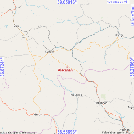
Alacahan GPS coordinates[2]
39° 6' 24.012" North, 37° 34' 32.016" East
| Map corner | latitude | longitude |
|---|---|---|
| Upper-left | 39.65016°, | 36.87244° |
| Center: | 39.10667°, | 37.57556° |
| Lower-right: | 38.55896°, | 38.27869° |
| Map W x H: | 121.3×121.3 km | = 75.4×75.4mi |
| max Lat: | 42.02683° ⇑43.8% North |
| Alacahan: | 39.10667° |
| min Lat: | ⇓56.2% South 35.9025° |
| min Long | Alacahan | max Long |
| 25.90902° | 37.57556° | 44.60099° |
| W 59.2%⇐ | ⇒40.8% E |
Elevation
Elevation of Alacahan is 1799 m = 5902 ft, and this is 1081.6 m = 3549 ft above average elevation for this country.
| Max E: |
2682 m = 8799 ft | 2.8% |
| Alacahan | 1799 m 5902 ft | |
| Avg. | 717.4 m = 2354 ft | |
Min E: |
0 m = 0 ft | 97.2% |
See also: Turkey elevation on elevation.city.
Geographical zone
Alacahan is located in North temperate zone (between Tropic of Cancer and the Arctic Circle). Distance of this Northern Tropic circle is 1742.3 km =1082.6 mi to South.| Distance of | km | miles | from Alacahan |
|---|---|---|---|
| North Pole | 5658.8 | 3516.2 | to North |
| Arctic Circle | 3052.9 | 1897 | to North |
| Tropic Cancer | 1742.3 | 1082.6 | to South |
| Equator | 4348.3 | 2701.9 | to South |


Nearby cities:
15 places around Alacahan: (largest is in red/bold)
• Beypınarı
45.9 km =28.5 mi,  14°
14°
• Danişment
54.2 km =33.7 mi,  82°
82°
• Deliktaş
41.3 km =25.7 mi,  309°
309°
• Gürün
50.2 km =31.2 mi,  211°
211°
• Hasançelebi
31.5 km =19.6 mi,  123°
123°
• Hekimhan
44.4 km =27.6 mi,  136°
136°
• Kale
37.5 km =23.3 mi,  102°
102°
• Kangal
21.3 km =13.2 mi, 311°
• Kavak
22.2 km =13.8 mi,  338°
338°
• Konakpınar
32.8 km =20.4 mi,  227°
227°
• Kuluncak
26.7 km =16.6 mi,  163°
163°
• Kuşkayası
43.1 km =26.8 mi,  263°
263°
• Mursal
33.6 km =20.9 mi, 78°
• Sincan
47.9 km =29.8 mi,  32°
32°
• Çetinkaya
17.8 km =11.1 mi, 14°
Sources, notices
• [Note1] Compared only with cities in Turkey existing in our database
• [Src1] Map data: © OpenStreetMap contributors (CC-BY-SA)
• [Src2] Other city data from geonames.org with taken over terms of usage.
• [Src3] Geographical zone / Annual Mean Temperature by Robert A. Rohde @ Wikipedia
