Mahmutlar geodata
Mahmutlar (Antalya) is a populated place; located in Turkey in Europe/Istanbul (GMT+3) time zone. With population of 24,227 people, there are 293 cities with bigger population in this country. Compared to other cities in Turkey, 97% of cities are located further ↑North; 66.2% of cities are located further →East and 98.6% of cities have higher elevation than Mahmutlar. Note1


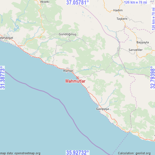
Mahmutlar GPS coordinates[2]
36° 29' 40.668" North, 32° 5' 27.06" East
| Map corner | latitude | longitude |
|---|---|---|
| Upper-left | 37.05781°, | 31.38773° |
| Center: | 36.49463°, | 32.09085° |
| Lower-right: | 35.92732°, | 32.79398° |
| Map W x H: | 125.7×125.7 km | = 78.1×78.1mi |
| max Lat: | 42.02683° ⇑97% North |
| Mahmutlar: | 36.49463° |
| min Lat: | ⇓3% South 35.9025° |
| min Long | Mahmutlar | max Long |
| 25.90902° | 32.09085° | 44.60099° |
| W 33.8%⇐ | ⇒66.2% E |
Elevation
Elevation of Mahmutlar is 8 m = 26 ft, and this is 709.4 m = 2327 ft below average elevation for this country.
| Max E: |
2682 m = 8799 ft | 98.6% |
| Avg. | 717.4 m = 2354 ft | |
| Mahmutlar | 8 m = 26 ft | |
Min E: |
0 m = 0 ft | 1.4% |
See also: Turkey elevation on elevation.city.
Geographical zone
Mahmutlar is located in North temperate zone (between Tropic of Cancer and the Arctic Circle). Distance of this Northern Tropic circle is 1451.9 km =902.2 mi to South.| Distance of | km | miles | from Mahmutlar |
|---|---|---|---|
| North Pole | 5949.2 | 3696.7 | to North |
| Arctic Circle | 3343.4 | 2077.5 | to North |
| Tropic Cancer | 1451.9 | 902.2 | to South |
| Equator | 4057.8 | 2521.4 | to South |


Nearby cities:
15 places around Mahmutlar: (largest is in red/bold)
• Alanya
9.8 km =6.1 mi,  303°
303°
• Avsallar
32.1 km =19.9 mi, 296°
• Demirtaş
11.9 km =7.4 mi,  129°
129°
• Eksere
36.4 km =22.6 mi,  347°
347°
• Gazipaşa
32.3 km =20.1 mi,  140°
140°
• Göktepe
49.7 km =30.9 mi,  72°
72°
• Güzelbağ
31.6 km =19.6 mi,  327°
327°
• Güzelsu
49.2 km =30.6 mi, 334°
• Köprülü
27.7 km =17.2 mi,  17°
17°
• Kızılağaç
56.1 km =34.9 mi, 297°
• Okurcalar
38.6 km =24 mi, 296°
• Payallar
24.5 km =15.2 mi, 298°
• Sarıveliler
51.7 km =32.1 mi,  64°
64°
• Tepebaşı
59.5 km =37 mi, 71°
• Türkler
26.9 km =16.7 mi, 296°
Sources, notices
• [Note1] Compared only with cities in Turkey existing in our database
• [Src1] Map data: © OpenStreetMap contributors (CC-BY-SA)
• [Src2] Other city data from geonames.org with taken over terms of usage.
• [Src3] Geographical zone / Annual Mean Temperature by Robert A. Rohde @ Wikipedia
